Trekking in Badia Prataglia Biogenetic Natural Forest
itineraries in the Casentino Forests, Monte Falterona and Campigna National Park
Texts and photos by Alessandro Ferrini ©
65 images in sequence to learn about this itinerary in the Casentino Forests. Click to start the virtual excursion
Itineraries from Campo dell'Agio near Badia Prataglia
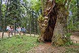
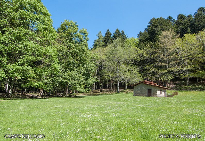
 A short distance from Badia Prataglia is Campo dell’Agio (photo above), a large meadow on the edge of the forest that can be reached on foot from the village square in just over half an hour, and by car by turning left next to the inn Il Carbonile, a couple of kilometres beyond Badia Prataglia in the direction of Passo dei Mandrioli. Campo dell’Agio, at an altitude of 1,026 metres, is also a large picnic area with a hut, fountain, cooker and many tables at the beginning of the woods. The place is a real joy for families with children, but also a reference point for trekking lovers. In fact, it is the starting and finishing point of various itineraries that twist and turn through the well-known Badia Prataglia Biogenetic Natural Forest, now incorporated in the Casentinesi Forest National Park. In this web section we will not deal in detail with a single route, but, by means of the map, descriptions and photos, we will show various itineraries in this splendid area of the National Park. It is difficult to recommend one excursion instead of another, each has its own peculiarities, but they all have in common the crossing of forests that, according to many, are the most beautiful in the Tuscan-Romagna Apennines. Much of the merit of this beauty can be attributed to the care they received in the 19th century from Carlo Siemoni, a forest technician commissioned for this purpose by the Grand Duke of Tuscany Leopold II of Lorraine. The most popular route is CAI 64, which in about three kilometres climbs to the 1,296 metres of the Crocina Pass passing by the Buca delle Fate. We first walk among large fir trees, then, gradually, the beech forest takes over. The section of the route from Buca delle Fate to Passo della Crocina makes us walk in an extraordinary beech forest with plants with sculptural roots and along the Fosso del Pontone which shows us a spectacular rock wall. At the crossroads on the ridge (Crocina Pass), we turn right onto GEA 00, which in just over two kilometres descends to Passo dei Cerrini, 1,238 metres. Then, in a kilometre and a half, after ascending to 1,360 metres on the northern slopes of Mount Cucco, we descend to 1,220 metres where we find on the right CAI 60, which in a couple of kilometres takes us back to Campo dell’Agio. On the lower part of this path, we re-enter a fir forest, passing by plants that are enormous in height and stem size. This loop in the Badia Prataglia forest is about ten kilometres long.
  If we want to reduce it, we can use a path (once CAI, now disused) that in a couple of kilometres connects Campo dell’Agio directly to Passo dei Cerrini. Halfway along this road, in an almost flat stretch, the beech forest is so thick that, when the plants have leaves, even on a sunny day, we feel as if we are walking in the dark, a real tunnel in the forest. If we want to undertake a slightly longer itinerary with a higher difference in altitude, once we reach Passo della Crocina with CAI 64 or from Passo dei Cerrini, we begin to descend the Romagna side of the Apennines with CAI 207. In about one kilometre we reach Passo della Bertesca where we turn right onto CAI 205 which, with a steep descent into an imposing fir forest, in another kilometre takes us to Pian della Saporita, 1,050 metres. Here we join MTB route 7, a driveway with a very limited gradient. CAI 205 continues on this, to the left, we go right. In about 4.5 kilometres we arrive at Passo dei Lupatti. The path we are walking on was a great work begun in the early twentieth century by Cav. Ubaldo Tonetti who had purchased the forest in 1900 from the heirs of Grand Duke Leopold II. The work, however, was not intended as a road, but as the site of a Decauville railway that, with a length of twenty kilometres, connected La Lama to Cancellino, a hamlet along the Passo dei Mandrioli road. The little train, pulled by small steam locomotives, was used to transport timber cut in the La Lama forest. At Pian della Saporita, from where we passed, there was a double track to enable convoys from opposite directions to interchange. In 1914, the forest became state property. The railway continued to operate until 1920 when it was dismantled to make way for a road that could be used by the first lorries.
  At Passo dei Lupatti (1,171 metres), we cross the GEA 00. To the left, the route heads towards Passo dei Mandrioli. We continue for some 20 metres and then take the ridge path to the right. First an ascent (up to 1,288 metres), then a descent in less than a kilometre lead us to the junction with CAI path 60, which takes us back to Campo dell’Agio. Badia Prataglia can be the starting point of the itineraries described if you decide to reach Campo dell'Agio on foot, or a crossing point if you arrive at this second location by car, as most people do. Whatever choice you make, in this ancient meadow (from which the name Prataglia derives) at an altitude of 830 metres, it is advisable to stop and visit its splendid church and fascinating crypt. It is what remains of an abbey (which gave its name to the place) founded around 990 by two monks from Cassino. The church that we can see today is the total makeover of the original one carried out in 1314. Then, over the centuries, it underwent other architectural modifications, but which did not disfigure its fourteenth-century appearance. In the area next to the rear of the church are a forestry museum and an arboretum, both named after Carlo Siemoni.


