FROM AIA DI GUERRINO TO THE LAMA FOREST
an itinerary in the National Park of the Casentino Forests
Texts and photos by Alessandro Ferrini ©
48 images with captions to know the path that goes around the Verna mountain. Click to follow the itinerary
An itinerary to get to La Lama from the Crocina Passo
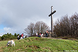
 From Badia Prataglia, a beautiful driveway that crosses the forest, goes up to Prato alla Penna, then, from here, down to the Hermitage of Camaldoli. Along this road (closed to cars in winter), after 3 kilometers going up from Badia, we find on the right a small open space just above the road. We are in Aia di Guerrino (1223 meters), the starting point of our excursion and also of another walk that in about a kilometer and a half takes us up to 1332 meters of Monte Penna a natural terrace that offers us an extraordinary panorama of Romagna, while below us we see the Forest of the Blade, the destination of the excursion we are about to describe.
This path, about 12 kilometers long, is considered among the most interesting of the Casentinesi Forests National Park as, in addition to offering us a superb nature made up of various species of plants, waterways and a spectacular waterfall, it takes us through a place , the Lama Forest, with an important history behind it that sees it linked to the Opera del Duomo in Florence, the Grand Duchy of Tuscany, the Camaldolese Fathers and, in the nineteenth century, to the "care" of the Bohemian forest engineer Carlo Siemoni .
The itinerary winds almost entirely in the land of Romagna. This would not have been the case until 1923. Until that year, in fact, this territory belonged to Tuscany. It was Benito Mussolini who moved the border between the two regions so that the Tiber, the river of Rome, had its source in its homeland, the Province of Forlì.
Interesting itinerary, unfortunately a bit tiring, not for the length, but for the difference in height it presents.
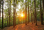
Our journey begins on the GEA 00 which comes from the driveway, crosses the Aia di Guerrino and enters the woods climbing slightly. After about 200 meters we arrive at a crossroads. The CAI 225 starts to the left and goes up to Monte Penna, we have to continue to the right on GEA 00 which begins to rise quite decisively. We continue like this, through a beautiful beech forest, for 1.2 kilometers, up to the 1436 meters of Poggio allo Spillo. The path passes to the left of the top of this mountain, to reach the top you have to leave the path. The dense vegetation, however, does not allow us to have views from this place. Back on the path, in less than 400 meters we descend to Passo della Crocina (1396 m), a historic crossroads. The GEA 00 continues towards Passo Lupatti and Passo dei Mandrioli. A bend to the right leads to CAI 64 which leads to Badia Prataglia, we turn left onto CAI 207 which, with a smooth descent among beautiful beech trees, takes us to the 1250 meters of Passo della Bertesca. This is another crossroads where we have to turn sharply to the left and begin to descend on CAI 223 which in about 4.5 kilometers will lead us to La Lama (694 m). After a few minutes we will have a beautiful view on our right, from this point we begin to find fir trees that will become more and more dense. The road degrades quite decisively, but being careful the path does not present treacherous sections. We entered the Valle dei Forconali, crossed by the ditch of the same name to which, for a long stretch,
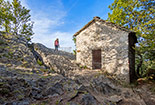
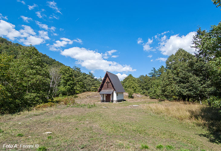
 we walk a few meters, thus, the silence of the forest is broken by the pleasant flow of water. Fir trees, almost all the same, have now become the dominant plants, but not the only ones. Along the way we meet other types of plants with very imaginative shapes. A beech tree has embraced a large boulder with its roots: a sort of symbiosis between wood and rock. La Lama looks like a large flat area full of water, with green meadows and woods. Closed on three sides by high mountains, it opens towards Romagna to the east. A small church awaits us in a clearing, a few meters from this there is a bivouac, then there is a large building housing the forest guards.
After having visited this place, we set off towards the return taking the CAI 229 which follows the Fosso della Lama. After a little more than an almost flat kilometer we leave it to turn left onto CAI 227 which climbs decisively from the first meters. The most difficult part of the route begins: in about 3 kilometers we will face a difference in altitude of 500 meters. We will walk next to the Fosso di Fangacci which descends from the pass of the same name, three hundred meters from the Aia di Guerrino, our starting point. The first kilometer of CAI 227 is the hardest. Some parts of the steep path consist of stairs. This is why it is known as the Path of the Scalandrini. Not far from this point there is a spectacular waterfall which can be reached in the lower part of the jump with a short detour. Carefully, if wet the narrow path can be very treacherous. After passing the Fosso Fangacci with a small and choreographic wooden bridge, the path, while maintaining a good climb, becomes gentler. We will continue along the ditch in a beautiful forest until we reach a crossroads. Very little is missing at the end of our loop route. We have to go left. A hundred meters before the Guerrino Hague we will find the Guido Fountain, a justified reason for a short stop to quench our thirst with fresh and pure water.


