Dalla Valle del Solano all’Uomo di Sasso
cultura e natura in un itinerario sul crinale e sulle pendici orientali del Pratomagno
Italiano
IL BIVIO PER PIAN DEI CILIEGI
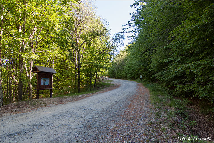
Dopo un paio di chilometri (prima parte in leggera discesa, poi leggera salita), giungiamo alla bacheca che vediamo nella foto. Ancora cinquanta metri e una strada a sinistra scende nella splendida faggeta. Questa pista forestale (chiusa da una sbarra) è anche il CAI 54 che in un chilometro e mezzo conduce a Pian dei Ciliegi, un pianoro dove si trova un'accogliente area attrezzata con un bivacco e una fonte che getta acqua continua in quantità abbondante. Questo testimonia quanto la montagna in questa zona sia ricchissima d'acqua (siamo a un chilometro e mezzo, in linea d'aria, da Bagno di Cetica).
Dopo altri due chilometri di discesa, pochi metri dopo un'altra sbarra, il CAI 54 diviene quasi pianeggiante e scorre in un'ampia radura erbosa. Siamo in località Badia alle Pratole che è raggiungibile da Cetica anche in auto partendo dalla parte alta del paese, da un nucleo di case chiamato Lupaia.
Il luogo porta questo nome perché nel 1262 i monaci di Vallombrosa vi costruirono una badia, Pratole perché edificata in un grande prato. Vi era anche un ospizio per rifocillare e ospitare chi transitava su quest'importante strada di collegamento tra Casentino e Valdarno attraverso in Varco di Gastra che questa escursione fi farà conoscere. Badia alle Pratole fu assegnata ai monaci di San Fedele, importante abbazia vallombrosana dentro le mura del Castello di Poppi. La storia di Badia alle Pratole, che aveva perso importanza già nel XVI secolo per la viabilità che stava cambiando, finì nel 1634 quando crollò sotto il peso di una copiosa nevicata. Divenne una cava di pietra già lavorata, oggi rimangono pochi sassi.
After a couple of kilometers (first part slightly downhill, then slightly uphill), we reach the notice board that we see in the photo. Still fifty meters and a road to the left descends into the splendid beech forest. This forest track (closed by a bar) is also the CAI 54 which in a kilometer and a half leads to Pian dei Ciliegi, a plateau where there is a welcoming area equipped with a bivouac and a source that pours continuous water in abundant quantities. This testifies how much the mountain in this area is very rich in water (we are one and a half kilometers, as the crow flies, from Bagno di Cetica).
After another two kilometers of descent, a few meters after another barrier, CAI 54 becomes almost flat and flows into a large grassy clearing. We are in Badia alle Pratole which can also be reached from Cetica by car starting from the upper part of the town, from a group of houses called Lupaia.
The place bears this name because in 1262 the monks of Vallombrosa built an abbey there, Pratole because it was built in a large meadow. There was also a hospice for refreshments and to host those who traveled on this important road linking Casentino and Valdarno through the Gastra Pass which this excursion will make known to you. Badia alle Pratole was assigned to the monks of San Fedele, an important Vallombrosan abbey within the walls of the Castle of Poppi. The history of Badia alle Pratole, which had already lost importance in the 16th century due to the changing road system, ended in 1634 when it collapsed under the weight of a heavy snowfall. It became an already worked stone quarry, today only a few stones remain.


