FROM CALLA PASS TO MONTE FALCO
an itinerary in the National Park of the Casentino Forest
Texts and photos by Alessandro Ferrini ©
50 images in sequence to learn about this itinerary in the Casentino Forests. Click to start the virtual excursion
To Burraia and Monte Falco from Calla Pass, trekking in the National Park
 The itinerary described in this web section takes us on a wonderful stretch of the Apennine ridge within the National Park of the Casentino Forests. Its point of departure and arrival is the Passo della Calla, at 1295 meters above sea level, reachable via the SS310 from Stia and Santa Sofia, depending on whether you are coming from Tuscany or Romagna.
Since ancient times, the Passo della Calla road has been a very important communication route. It was already used by the Etruscans, but even more by the Romans in their movements towards Romagna.
It was probably in the Middle Ages that this Apennine pass took the name Calla, a frequent term. They were the places where it was counted, that is, customs points. What did it count? Generally the sheep, that is, those precious animals that produced the white gold of the time, the wool. The transhumance that the Casentinesi shepherds practiced towards the Maremma is known, this movement involved a very large number of flocks. Although with much lower numbers, there was also a transhumance towards Romagna that interested the shepherds of the highest part of the Casentino and this was the most used road.
Returning to the trekking route, this does not require a particular physical commitment. It is an itinerary that has a total length of about 12 kilometers. The outward journey takes us up from the 1295 meters of Passo della Calla to the 1658 of Monte Falco, the highest point of this itinerary, as well as of the National Park, but the five kilometers that separate Passo della Calla from this peak do not present particularly demanding slopes because the 360 meters of difference in altitude are well distributed along the entire route.
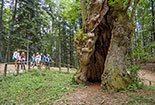
 Leaving the car in the large parking lot along the road, we take the GEA 00 ridge route heading north which is located next to the intersection of the two asphalted roads. After fifty meters we find a particular religious shrine built on a large trunk and dedicated to the Madonna of the Forest. A few meters after this we are already inside a beautiful beech forest, trees that are not large but particularly dense which, despite being on the Apennine ridge, hide all views and even the sky from us. In some places the path is a real channel, we have the sensation of walking in a tunnel inside a fairy-tale forest. After a first uphill stretch, the path becomes wider and flatter. In a couple of points the vegetation thins out allowing us to have beautiful views towards the east, that is, over Romagna.
Forty minutes walk and we come to a large building: the Burraia, known as Casone della Burraia. We are 1447 meters high. Today it is a well-known refuge managed by the CAI section of Stia. There is also a forest documentation point open on summer weekends, when the transit of walkers on this path is high. The structure was built in the nineteenth century, in the Grand Ducal period, in the period in which the Grand Duke Pietro Leopoldo had entrusted the management of the Lama Forest and Campigna to the forest engineer Carlo Siemoni. It was the latter who had the building built. Here were the stables for the animals that were used to work in the woods. Here, butter was produced from the excellent milk supplied by the pastures on these mountains. That's why the name Burraia. Name that will identify the whole area adjacent to the "Casone" also called by someone Colonia della Burraia because in the 1950s the structure was used as a mountain residence.
 The place is very cool because it faces north-east, excellent for storing butter but also for a stop during a summer excursion. A few meters from the building there is a source to cool off and fill our water bottles.
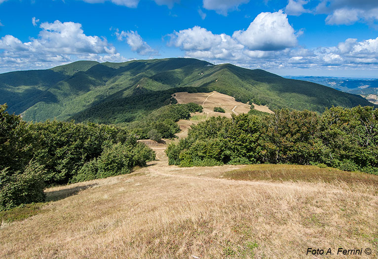
Fifty meters beyond the Casone della Burraia, the wood ends sharply and in front of us we have a large meadow, we are in the well-known Prati della Burraia. If up to this point the excursion had been lacking in views, from here we have an extraordinary view to the east. If it is not difficult for us to get up early, it is worth coming to this place to enjoy the sunrise. Indescribable sensations and colors, to understand what awaits us better look at the three photos at the end of this text. In the lower part of the meadow we see a large building, the Città di Forlì Refuge. An elegant structure with a restaurant, bedrooms and a room for conferences and documentary meetings. If we go up to the highest part of the meadow we will be on the Apennine ridge, from here we have a beautiful view of the Casentino valley bordered to the west by the Pratomagno massif.
To the south of the Prati della Burraia there is a hill: Monte Gabrendo. With a few hundred meters we can reach the 1549 meters of this peak. From here we can dominate the large meadow and see part of the Apennine ridge which heads north-west. We will notice the pylons of a military station located on the Sodo dei Conti hill at 1560 meters, beyond we will see Monte Falco (1658 m), the destination of this excursion. Further on on the left we will distinguish the profile of Monte Falterona, 1654 m.
After this view it will be easier to decide whether to reach Monte Falco or return to Passo della Calla.
 In the first case we will have to cross the large meadow and continue along the GEA 00 route for about 2.5 kilometers, climbing 160 meters. In the second case, after descending from Monte Gabrendo, we will turn left onto CAI 86. This route descends constantly through a mixed forest until we reach CAI 82. We will take this path on the left which, passing by gigantic beech trees, leads us to Passo della Calla.
Extraordinary places such as Prati della Burraia, Casone della Burraia, Monte Gabrendo can also be reached by those who have less opportunity to walk. From Passo della Calla continue by car towards Burraria - Fangacci. After 1.9 kilometers we will find a large parking lot on the right, where we can leave the car. We continue on foot on the road for about a hundred meters, then we will turn left onto CAI 253. This path, in about twenty minutes of gentle ascent into a beautiful wood, leads us to the Prati della Burraia. We can further shorten the path. CAI 253 is also accessible by car up to a barrier. On the left there is a parking lot. From here we will reach the large lawn in ten minutes. The last four pages of the photo gallery illustrate this path. We continue the excursion to Monte Falco. On the Prati della Burraia we take the GEA 00 northwards. A steady but not demanding climb accompanies our journey that offers us beautiful views of the Casentino. In about 25 minutes we reach Poggio Sodo dei Conti where there is the military station seen from Monte Gabrendo.
 To get around it we have to leave the ridge for a short distance and use a path that passes further down. As soon as we pass the military structure, before returning to the woods, we can enjoy a spectacular view towards the south-west. From here the climb becomes less and less demanding. After 15 minutes we leave the wood again to enter a plateau where we meet a path that comes from the right. It is the GEA 00 SOFT (better known as Pista del Lupo) which climbs from Passo di Piancancelli. We continue straight, walking again among the beech trees and in five minutes we reach the 1658 meters of Monte Falco, the “roof” of the Casentinesi Forests National Park. To the east it offers us spectacular views of Romagna, a few tens of meters further on there is a sort of balcony with a bench that allows us to admire an extraordinary panorama towards the north: the Mugello is below us, when there is good sharpness atmospheric we can see the Veneto and Friuli Alps, further to the left we see the Apuan Alps.
From Monte Falco it takes about 40 minutes to reach the top of Monte Falterona but we, after enjoying the views just described, take the way back. At Prati della Burraia, let's remember to take CAI 86 which passes to the right of Monte Gabrendo. Shortly before entering CAI 82, we will cross a clearing from which we have a beautiful view towards the south-west.


