FROM CAMALDOLI TO POGGIO SCALI
an itinerary in the National Park of the Casentino Forest
Texts and photos by Alessandro Ferrini ©
67 images in sequence to learn about this itinerary in the Casentino Forests. Click to start the virtual excursion.
Trekking and mountain biking in the National Park: from Camaldoli to Poggio Scali
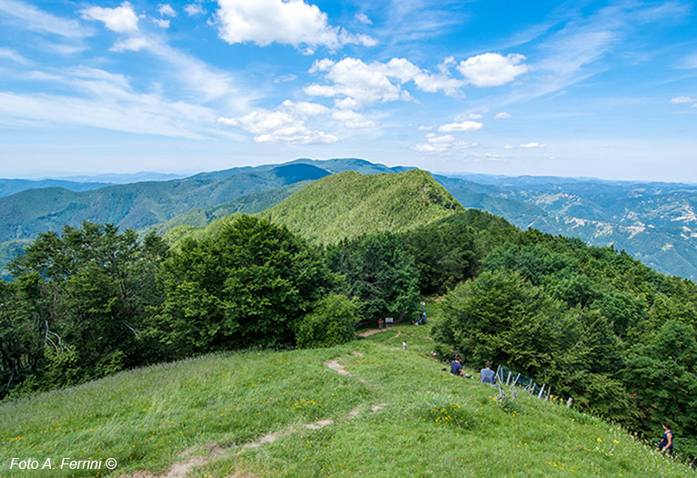
 Within the National Park of the Casentino Forest, Monte Falterona and Campigna, Poggio Scali is one of the most interesting landmarks for trekking enthusiasts. The summit, at 1520 meters above sea level, is located on the Tuscan-Romagna Apennine ridge, along the GEA 00 route which from Passo della Calla heads towards Prato alla Penna. The latter is a grassy space located just above the Hermitage of Camaldoli which can also be reached by car since it is located along the road that leads from this sacred place to Badia Prataglia. The section of GEA 00 between Passo alla Calla and Prato alla Penna is commonly known as Giogana. In the Divine Comedy Dante Alighieri calls it "great yoke" (Canto V of Purgatorio, verse 116). The route is one of the most popular in the National Park, both for lovers of trekking and mountain biking.
This web section describes how to reach Poggio Scali from the Camaldoli area. There are various routes, the most used is the one that starts right from Prato alla Penna, also because it is the least demanding. In fact, we begin the walk at an altitude of 1248 meters and following exclusively the GEA 00 ridge path towards the north, after about six kilometers of ups and downs we reach Poggio Scali. The last two kilometers are those that require more physical effort, from the 1330 meters of La Scossa we climb to the 1520 meters of our destination which offers us a beautiful view of Monte Falterona (northbound). Towards the south we follow the Apennine ridge with our eyes and we will notice the Monte della Verna with its unmistakable square shape. To the east and west are Romagna and the Pratomagno massif respectively. These last two views are, unfortunately, limited by the vegetation around the small lawn that is located on the top of Poggio Scali.
This itinerary plans to use the same stretch of GEA 00 for both outward and return journeys.
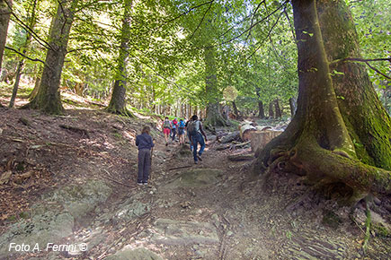
 Then the images in sequence in this section, after showing us in the first four pages the short stretch that from Prato alla Penna leads to Passo Gioghetto, will lead us on a path that starts from the Sacred Hermitage of Camaldoli and on the way back will introduce us to other areas of the forest. This hike in the National Park will be more challenging, not so much because it is longer than about five kilometers, but because of the greater difference in altitude it presents. The map, on page 5 of the sequence, clearly illustrates this. As already mentioned, departure and arrival are scheduled at the Hermitage of Camaldoli, at an altitude of 1102 meters, a place of great historical, religious and artistic importance. The excursion will therefore be an opportunity to visit it.
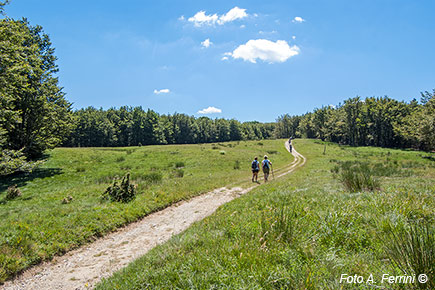
The beginning of this trek, on CAI 70, is behind the Sacro Eremo and will take us up to the 1240 meters of Passo Gioghetto where we will cross the GEA 00 which we will take to the north. After about 1.5 kilometers the path finds CAI 68 on the left, this is the road that will take us back to the Hermitage of Camaldoli. Then the GEA 00 takes us across a large grassy area slightly downhill, it is Prato al Soglio, at 1350 meters above sea level.
 After walking among majestic beech trees, we go up to 1382 meters of Giogo Seccheta. Here we cross the CAI 76 on the left which we will go up on the return journey. This path is referred to as "Via dei Legni". It was used to lower the long spruce trunks to Pratovecchio that the Arno would then transport to Florence and Pisa. Continuing on the GEA 00, this descends to 1330 meters of La Scossa, an ancient pass on the Apennines, then begins its ascent towards Poggio Scali. After about a kilometer we find Passo Porcareccio, 1452 meters. Here comes the CAI 78 from the left which we will take on the way back. Another kilometer and we will reach the 1520 meters of Poggio Scali. After enjoying the wide views that this place offers us and resting on the small meadow, we descend from this cone-shaped peak on the north side, but before turning back it is advisable to continue on the GEA 00 towards Passo alla Calla. After about two hundred meters we will have a beautiful view to the east that Poggio Scali had denied us due to the dense vegetation. At this point we reverse gear, at the foot of Poggio Scali we follow the path to the right. Going back on GEA 00, after a kilometer we turn right onto CAI 78 which after 1.5 kilometers of constant descent will cross the MTB route 8 which we will take to the left. In 2.5 kilometers we will descend to 1130 meters of Capanna La Maremmana. After crossing a ditch with a wooden bridge, the MBT 8 route begins to climb and in about seven hundred meters leads to the Pian del Varco area, 1240 meters. Here there is a lawn with a welcoming equipped area, an excellent place to rest and have a tasty sandwich. It is about five hundred meters from the road that descends from the Hermitage of Camaldoli to Lonnano di Pratovecchio. At Pian del Varco we find the CAI 76 (Via dei Legni) that we crossed on the ridge path. We begin to climb it and after a hundred meters we find ourselves in a place called "Femmina Morta".
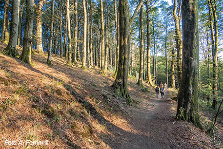 We continue our journey in a splendid forest and in about 1.4 kilometers of ascent the path takes us back to Giogo Seccheta, along the GEA 00 on which we set out in a southerly direction. After crossing Prato al Soglio again, we will meet CAI 68 on the right which will drop us off at the starting point of the itinerary: the Hermitage of Camaldoli.
Looking at the map on page 5 of the sequence, we can also manage this 16.5-kilometer hike in a personal way, shortening the route and varying the elevation gain.
A shorter itinerary to reach Poggi Scali (about 11 kilometers) starts and ends in Battilocchio, at 1200 meters above sea level, along the driveway that leads from the Camaldoli Hermitage to Lonnano di Pratovecchio. From here begins the CAI 76 path (Via dei Legni) which in five hundred meters leads to the Pian del Varco area and then climbs the Apennine ridge, where it joins the GEA 00 path that this time we will take to the north. After reaching Poggio Scali, on the way back we will still use the CAI 78 and MBT 8 routes, previously described, to return to the starting point.


