A journey of Francesco in Alpe di Catenaia
Franciscan itinerary between the Prati della Regina and the Casella Hermitage
Texts and photos by Alessandro Ferrini ©
60 images with captions to know the path that goes around the Verna mountain. Click to follow the itinerary
An itinerary in the Alpe di Catenaia in the footsteps of San Francesco
 Among the relics housed at the Sanctuary of La Verna, the most important and fascinating is undoubtedly a habit that, according to tradition, is the one that Saint Francis was wearing at the time he received the stigmata on this ‘naked crag’, 17 September 1224. It is displayed in a chapel of the basilica. With the itinerary described in this web section we will walk for the most part on that road traveled by the Poverello of Assisi, wearing this habit, on 30 September 1224, when he left La Verna for the last time to return to Assisi. A route that winds along the Alpe di Catenaia, with a length of about seventeen kilometers and a total height difference of 1150 metres. As it is structured, by observing the map it can easily be reduced. The starting and finishing point of our hike is Fonte del Baregno, a large picnic area at an altitude of 1,180 metres. This walk, as well as taking us through the traditions associated with St Francis, will also make us think about the sadly true history of the Second World War. In fact, we will come across evidence of the bloody battle fought on this mountain between 3 and 10 August 1944 by retreating German soldiers and British, Indian and Nepalese soldiers on the other front. To get to Fonte del Baregno, we must first reach Subbiano, along Regional Road 71, twelve kilometres from Arezzo. The town is worth a visit because in its historic centre we can see what was once a medieval castle on a sort of promontory along the Arno and some elegant palazzi built between the 14th and 17th centuries. Just before Subbiano, coming from Casentino, we turn left for Falciano, which we find after three kilometres. For centuries the village was an economically important place because so much flour (chestnut flour in particular) was produced here. There are as many as four mills in little space built on different levels so that their heavy stone grinders could harness energy from the same water. Three and a half kilometres beyond Falciano, we come to a fork in the road. To the right we descend to Ponte alla Piera, in the municipality of Anghiari, a small village known for the presence of a medieval humpback bridge, which, according to tradition, is of Roman origin. We go left and after about six kilometers we reach Fonte del Baregno. The area, equipped with stoves, two sources and many tables in the shady beech forest, is a very popular place for those who, in addition to a walk, also want to have a lunch, a snack or a dinner in an enchanting forest. Having left the car, we begin the excursion by going right, on CAI 013, which coincides with a forest road. In eight hundred metres it will lead us to a place called Cul di Paiolo, at 1,250 metres, which is affected by various paths. We can also avoid the first three hundred metres on the forest track by passing inside the picnic area, then inside the forest via a road that we meet on the left. We will save a hundred metres, but more than anything else we will cross a beech forest with beautiful plants.
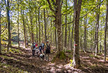
  At Cul di Paiolo, CAI 013 meets CAI 50, which descends from the left. Overlapping, they continue together for about sixty metres. Then, while 50 continues straight ahead, 013 turns left heading for Casa del Vaccaio, which is our destination, but we will use another route. At the crossroads, we leave CAI 013 turning onto CAI 50, which is a forest track. After five minutes of slight ascent, at a large beech tree on our left, the road enters a sort of gully and begins to climb more consistently. After seventy metres, just after a slight bend to the right and where the path becomes flat again, if we enter twenty metres into the beech forest, on the right, we find a crater-shaped hole a couple of metres deep. – ‘It is the effect of a bomb fired by the 44th division of the Austrian artillery, in force with the German troops. Back on the road, we continue uphill and after five minutes we come to a barrier. From here to the ridge of the mountain, where CAI 50 turns left towards Mount Castello, five hundred metres are missing. After a hundred metres we turn right onto a path entering a wonderful forest. After about a kilometre of undemanding ups and downs, we reach the Casa del Vaccaio, surrounded by massive beech trees, on a plateau near the ridge of the Alpe di Catenaia. This building, now a mountain hut for trekkers, is the rebuilding, done around 1980 by the Subbiano municipality, of a modest construction that had been built by Patrizio Landucci, a young man who in this mountain, from 1946 dedicated himself to the breeding of cows (keep in mind that many lands on the top of Catenaia, now occupied by woods, were pastures at that time). A few meters after the Casa del Vaccaio we find the CAI 013 that we had left in Cul di Paiolo. Here it arrives from the right and continues towards the ridge of the mountain which it reaches in two hundred meters and where it crosses the CAI 014 which runs over the Prati della Regina, a beautiful and long grassy clearing on the apex of this massif which divides the lower Casentino from the upper Valtiberina. Our itinerary turns to the left, but first we descend for two hundred metres to the end of the meadow, where the woods come alongside the path. We are in a very damp area of the mountain, we can tell this by how lush the beech trees are. After another few dozen metres, not far from the path, on the left, there is a pond called Pozza delle Strosce. At this point, we switch gears and begin to climb the beautiful meadow, which between the first days of May and the end of June is coloured with many varieties of flowers.
  In ten minutes we reach the 1,407-metre rounded summit of Mount Altuccia, unmistakable for the presence of three telecommunications pylons. Until not so many years ago, its peak offered a 360-degree panorama, but today the plants along the route have grown so tall, this greatly limits the view. Towards the east, among the beech trees, we can see the plateaus of Sassi Simone and Simoncello. From Mount Altuccia we begin a not steep and almost constant descent. A few minutes and we pass by a stretch of woodland that on our left reaches the path. Between these trees we come across CAI 50, which we had left four hundred metres below to head for the Casa del Vaccaio. Here CAI 014 ends, we continue on CAI 50 which, having reached the ridge, turns left. A few more minutes and we come to a slight slope, the largest grassy area of the Prati della Regina. This clearing goes down towards the south-west and offers a wide panorama of the lower Casentino, where we can see the villages of Subbiano and Capolona, the city of Arezzo and the initial part of the Upper Valdarno. After a few minutes of gentle climbing on the CAI 50, we reach the highest peak of the Alpe di Catenaia, Mount Castello, at 1,414 metres. Here there is a monument to the partisans who fell in this area in 1944 during clashes with Nazi-Fascists. After a few metres, the CAI 50 begins to descend quite steeply, entering a thick beech forest. A hundred metres along the path and, where the concrete posts of a former fence end, to the left, three metres from the path, another deep crater is found. Like the previous one, this one was generated by an Austrian bomb. As we continue to go down, the forest becomes more airy, partly due to a recent cut, and allows us an amazing view to the northwest where we can see the upper Casentino with the Apennine ridge on the horizon. As we are lowering in altitude, further to the right, Mount of La Verna starts standing out against the sky. At the bottom of this we distinguish the small town of Chiusi. After about half a kilometre from Mount Castello, we inadvertently begin to walk on CAI 085. In fact, CAI 50 bends to the left, but the crossroads, at the time of writing, is closed by vegetation, so we cannot see it. We continue along the new path, which in another five hundred metres crosses CAI 012. This is a forest road that we take to the left. After an almost flat kilometre inside the forest, CAI 012 ends and we return to CAI 50, which descends from the left. Five hundred metres and we come to another crossroads. The road we must follow is the one continuing uphill. To the left, however, CAI 03 begins, which leads to Fonte del Baregno in ten minutes. At the crossroads, on the right, there is what remains of a path that enters the woods.
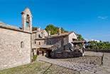
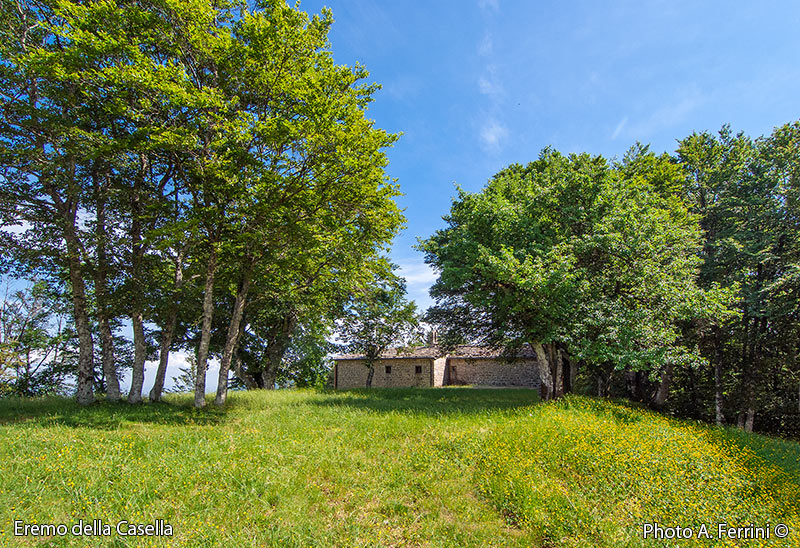
  In about ten metres it takes us past some holes in the ground, which were two German trenches. We continue on CAI 50, which has become an even wider forest road. After three hundred metres we reach the Sasso della Regina meadow, 1,248 metres. Its name is due to the presence, a short distance to the south of the path, of a deep cliff whose wall is supported by spectacular rocks. We are at the most scenic spot on the Alpe di Catenaia, and it is no coincidence that two benches facing the opposite direction have been placed there. Above, we can see the pylons of Mount Altuccia. To the southwest we can admire the lower Casentino, Arezzo and the Pratomagno Massif. To the north there is Mount of La Verna, but we only glimpse it because it is almost completely covered by the hill of the Eremo della Casella where we are heading. Further to the right, the horizon is marked by many other mountains, including the unmistakable plateaus of Sassi Simone and Simoncello. After enjoying the panorama of Sasso della Regina, we set off again for the Eremo della Casella. A four and a half kilometre walk awaits us, all on the CAI 50. The road is wide and for the most part shady. It runs in a pleasant up and downhill course through a mixed forest, mostly made up of beech trees. After 2.8 kilometres we find, on the left, a road. This is CAI 028, which leads to Chitignano (6.3 kilometres). From the Sasso della Regina we have descended about one hundred metres. We continue on CAI 50, which crosses a beautiful beech wood and after seven hundred metres comes to a crossroads with a dirt road that, to the right (GEA 20A), goes down to Caprese Michelangelo. We continue uphill on CAI 50, which from here also becomes a GEA route. In one kilometre, with some fairly uphill stretches, we arrive at Eremo della Casella, at 1,265 metres. The building, standing in the southern part of the large meadow, includes the church and the former hermitage, now a refuge with many rooms. Both these rooms are always open, in the sign of hospitality, one of the cornerstones of the Franciscan philosophy. The date of construction of the hermitage is not known, it can in any case be traced back to the second half of the fifteenth century, but its origins, certainly in very humble forms, could be much older, perhaps dating back to the years immediately following the last passage of Saint Francis. In fact, Fra Francesco, in his last visit to this place on 30 September 1224, allegedly expressed the desire that a humble house intended to house a hermit.
  A confirmation of the realization of this desire can be found in a document dated 30 September 1228 (exactly four years after the passage of San Francesco) where for the first time mention is made of the Eremo della Casella. What is certain is that after the canonization of the friar of Assisi on 16 July 1228, the Casella became a place of pilgrimage. From this beautiful meadow we can only partially enjoy that wide panorama that San Francesco will have observed. The tall vegetation that has grown around the lawn greatly limits the view. However, among the foliage of the beech trees, it is possible to see the highest part of Monte della Verna, the Fumaiolo, the Sassi Simone and Simoncello and, below, the Valtiberina, unmistakable due to the reservoir of Montedoglio on the course of the Tiber, the most large lake in Tuscany. After having rested and relaxed in this almost mystical place, we can take the road back, following the same route up to three hundred meters after the meadow of Sasso della Regina. Here we leave the CAI 50 to take the CAI 03 on the right which, going down, takes us back to the Fonte del Baregno in a few minutes. In the sequential pages of this web section, other aspects of this journey on the Alpe di Catenaia will be illustrated, starting with the history of the robe of San Francesco now exhibited at La Verna, the last passage of the friar of Assisi from the Casella, the dramatic World War II on this mountain, the hard and romantic story of Patrizio Landucci.


