The Buite Casetta and Hinkler's path
an itinerary in Pratomagno, the massif between Casentino and Valdarno
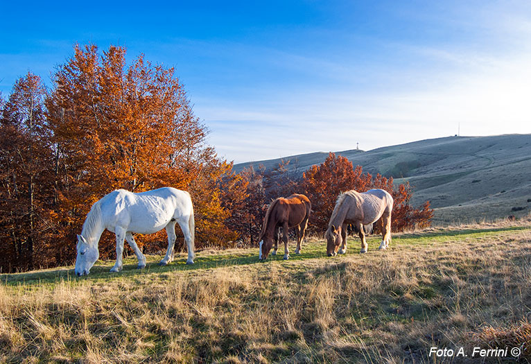
Texts and photos by Alessandro Ferrini ©
70 images in sequence to learn about this itinerary in Pratomagno. Click to start the virtual excursion
In Pratomagno to the Buite Casetta, to the famous cross and on the Hinkler ring
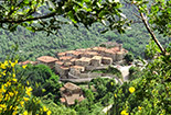
 The excursion we are about to describe can be an opportunity to visit characteristic villages on the slopes of Pratomagno that originated from medieval castles. In fact, the car ride that takes us to the starting point of the trek passes near or next to these places that may seem almost unreal to those who live immersed in the current frenetic and technological pace of cities. These fascinating villages are Raggiolo and Quota for those who climb the mountain from the Casentino, Trappola for those arriving from the Valdarno. The banners at the end of the text will allow you to access a detailed guide of these places.
The starting point of the walk is the Da Giocondo restaurant, which can be reached easily and comfortably because it is located along the connecting road between Casentino and Valdarno which passes a short distance from the famous Pratomagno cross. The path has a length of about sixteen kilometers, its altitude can be summarized as follows: in one kilometer from the 1395 meters of the restaurant you go down to an altitude of 1320. Three almost flat kilometers up to the Casetta di Buite and then climb up to the 1594 meters of Poggio Pianellaccio, a short distance from the cross. After a few ups and downs on the ridge up to Varco alla Vetrice (1450 meters), we descend steadily to 1320 meters in Prato alle Vacche, the area where the monument to Hinkler is located, then we go back to the starting point.
Now let's describe in more detail the itinerary which, if desired, can be reduced to ten kilometers, we'll see how. We begin to descend along the fence of the restaurant, we are on CAI 42. In just over a hundred meters we enter the paved road that we will leave after just another hundred meters to return to the right on CAI 42.
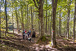
 We continue on this path for 800 meters until you return along the driveway where there is a clearing used for imposed timber. We are at 1320 meters. The CAI 42 crosses the road and heads towards Strada in Casentino, we turn right onto the CAI 42C. It is a forest road and after passing a barrier at its beginning we enter a beautiful wood. In this first section, the CAI 42C offers us beautiful panoramic views of the Casentino, the Apennine ridge, and Monte della Verna. The road is almost flat, only with pleasant ups and downs. We will cross some waterways, including the Teggina, one of the two streams of Raggiolo. This itinerary also includes a visit to its source. After about 3 kilometers, the CAI 42C ends by entering the 42A which climbs up from the left. This path in less than two hours allows us to go down to Raggiolo. We continue straight. After only about twenty meters we will follow the CAI 42A which turns right, the forest road continues straight ahead. About two hundred meters and we are on a plateau with majestic beech trees where the Casetta di Buite is located, 1345 meters above sea level. Today it is a welcoming refuge for trekking lovers, once it was a shelter for woodcutters, charcoal burners, shepherds. The place is also an area equipped with many tables in the beech forest, the water from its source is excellent and fresh. From here, in twenty minutes of constant but not demanding ascent, the CAI 42A takes us to the border point between the forest and the meadows of Pratomagno. We continue to walk on the path that runs along the edge of the forest. After a few meters, on the left, we have a beautiful meadow that climbs towards the ridge of the mountain. On the horizon we see the top of the famous cross.
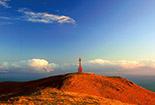
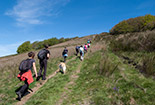
 It will be from this point that the climb on the lawn to the top of Pratomagno will begin, but first let's go to see the source of the Teggina, as well as Fonte del Duca. We continue, therefore, on CAI 42A which re-enters the woods. After five minutes of walking we meet a ditch that crosses the road on a curve to the right: it is the Teggina stream, still a stream here. At this point, with caution, we begin the ascent of the small stream. We will see the anti-breakthrough walls of the ground and after just over a hundred meters we will arrive at its source, better known as Fonte del Duca: a truly delightful hydraulic work within a beautiful natural environment. Let's go back on 42A to the meadow seen previously and start climbing it. After a few meters we find a sort of path transversal to our path, we begin to follow it to the left. In about two hundred meters it takes us to another lawn, much larger and which has the shape of a large basin. We begin to climb it, this path is probably the most beautiful and most fascinating way to get to the ridge and the famous cross. The horizon is marked by the borderline between the meadow and the sky. We proceed calmly because the climb is quite challenging, but mainly to enjoy the beauty of this environment. Every now and then let's not forget to look back, we will have a spectacular view of the Casentino and the Apennine ridge. Since we left the CAI 42A, the path made on the meadows is not marked on any map, but here there is no danger of getting lost, just go up and we will always arrive at the CAI 00 on the ridge with the large cross as an unequivocal point of reference. It is precisely at CAI 00 that we arrived by going up the lawn, the cross is about five hundred meters away. Let's walk along the ridge towards it (1592 meters). From up here we will not only have a great view of the Casentino, but also of the Valdarno up to Florence. Beyond the city, if the atmosphere is clear, we will see the Abetone mountains and the Apuan Alps. Towards the south-west we see the unmistakable Monte Amiata, further to the left extends the Valdichiana
 at the bottom of which we see Lake Trasimeno.
From the cross we continue towards the next hill: Poggio Pianellaccio. It is the "roof" of this excursion, we could not climb more, with its 1594 meters it is the highest point of the massif. In this section, CAI 00 coincides with the HR, that is a circular route dedicated to Herbert Hinkler, an Australian aviator who crashed on Pratomagno on 8 January 1933. On Poggio Pianellaccio there is a memorial stone in honor of him. He did not fall on this summit, but below. Towards the end of the excursion we will pass by the place where the plane and his body were found.
From Poggio Pianellaccio the CAI 00 and HR continue in a north-easterly direction on a service road that descends to the parking and equipped area Le 3 Fonti. After about three hundred meters, CAI 00 and HR leave the road on the left to follow the ridge of the massif. Being a ring, the HR also continues on the road but leaves it a few meters further on, always on the left, to cross Poggio delle Portacce and descend, in about thirty minutes, to the Da Giocondo restaurant, the starting point of our excursion. The path initially runs on a meadow heading towards an unmistakable tuft of beech trees, then descends into a dense beech forest. It offers us a beautiful view on the highest part of the Casentino and on Monte Falterona. If you want to limit our excursion to about ten kilometers, we can opt for this route. We, on the other hand, continue on the CAI 00 and HR of the ridge to cover the wider ring. We quickly descend to the 1460 meters of Varco ai Gioghi, unmistakable because the tunnel of the driveway passes underneath. We begin to ascend. After a few meters the CAI 00 keeps to the right of the ridge, on the Casentino side of the mountain. The HR, on the other hand, rises to 1515 meters at Poggio Varco di Castelfranco. We will use this second route, it will offer us more spectacular views and a beautiful lawn. From this peak the short descent towards Varco della Vetrice (1450 meters) will begin. For many centuries this crossing of the Pratomagno was very important because it connected the Solano valley in Casentino
  to Castelfranco di Sopra in Valdarno. Shortly before reaching this step, CAI 00 and HR are reunited. At Varco alla Vetrice we leave the ridge starting to descend towards the east on the large lawn. This short stretch of our route is not marked on the maps, but you can't go wrong. After the lawn, we will walk for a hundred meters inside a beech forest. After this, we will enter a large meadow, we have reached Fonte Cerbareccia. In this place at 1352 meters above sea level, there is an area equipped with tables among lush beech trees. On the lawn we find the HR path that descended from the ridge taking a different direction from ours. From now on we will always stay on this path that will bring us back to the starting point of our itinerary. Fonte Cerbareccia is located along the dirt road that leads from the Pratomagno tunnel to Monte Secchieta. We take it to the left and after two hundred and fifty meters we turn right to follow the HR which enters a beautiful beech forest. After just over a kilometer we will find a detour to the right. The signs present indicate that the road leads to the Hinkler monument which we arrive in about two hundred meters. Back on the main route, in just over 1.5 kilometers we will arrive at the paved road that comes from Quota. We are only a hundred meters from the Da Giocondo restaurant, the starting point of this excursion.
The seventy images with captions in the photo gallery describe this itinerary better than words. They show different times of the day and year. Deliberately, to make it clear howbeautiful Pratomagno is at any time of day and in all seasons.


