Il Rifugio di Buite, la Pozza Nera, la croce
un itinerario nel cuore del Pratomagno, il massiccio tra Casentino e Valdarno
Italiano
ITINERARIO BUITE – POZZA NERA – CROCE PRATOMAGNO 15
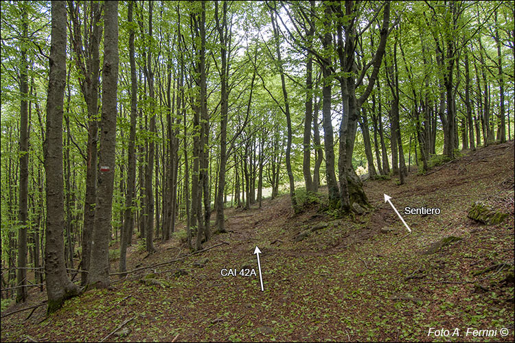
Ripreso il cammino su CAI 42A, dopo pochissimo, a destra, inizia un sentiero (praticamente invisibile se non si sa che c’è, comunque indicato nella mappa) che attraverso boschi e prati conduce a Prato Romito sul crinale del massiccio. Luogo da cui passeremo al ritorno. Quindi, questo sentiero può essere parte di un facile itinerario ad anello in questa zona del Pratomagno. Nel prato cinquanta metri più avanti, il sentiero è molto più evidente (pagina successiva). Resuming the path on CAI 42A, after a short while, a path begins on the right (practically invisible if you don't know it's there, however indicated on the map) which leads through woods and meadows to Prato Romito on the ridge of the massif. Place from which we will pass on our way back. Therefore, this path can be part of an easy circular itinerary in this area of Pratomagno. In the meadow fifty meters ahead, the path is much more evident (next page).


