Il Rifugio di Buite, la Pozza Nera, la croce
un itinerario nel cuore del Pratomagno, il massiccio tra Casentino e Valdarno
Italiano
ITINERARIO BUITE – POZZA NERA – CROCE PRATOMAGNO 8
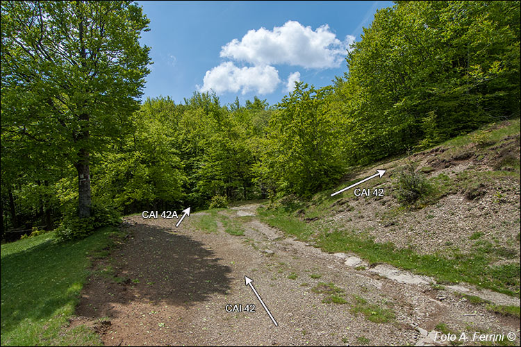
Alla fine della radura il CAI 42 volta a destra di 90 gradi e inizia a salire lungo il bosco. Proseguendo dritto, oltre il faggio che vediamo a sinistra la strada diviene CAI 42A e, iniziando a scendere, dopo qualche decina di metri ci fa attraversare il torrente Teggina (siamo a poco più di cento metri dalla sua sorgente). At the end of the clearing the CAI 42 turns right by 90 degrees and begins to climb along the wood. Continuing straight, beyond the beech tree that we see on the left, the road becomes CAI 42A and, starting to descend, after a few tens of meters it takes us across the Teggina torrent (we are just over a hundred meters from its source).


