Un cammino di Francesco sull’Alpe di Catenaia
itinerario tra i Prati della Regina e l’Eremo della Casella seguendo il Santo d’Assisi
Italiano
CAMMINO FRANCESCANO SULL’ALPE DI CATENAIA 3
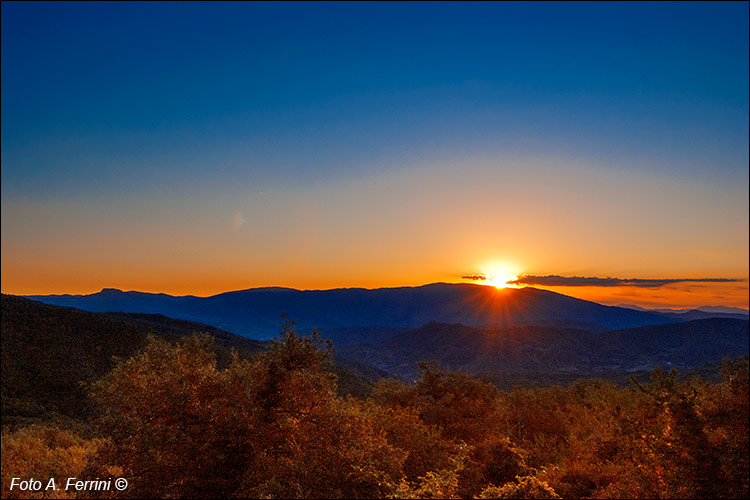
Una suggestiva alba dietro l’Alpe di Catenaia vista dal massiccio del Pratomagno. Il profilo della montagna è una sorta di mappa del cammino che San Francesco fece il 30 settembre 1224. Partito dalla Verna, il piccolo sperone sull’orizzonte, a sinistra, prima discese, poi salì sul Monte Foresto (La Casella), quindi raggiunse i monti più alti di Catenaia (Castello e Altuccia) per poi raggiungere il Castello di Montauto sulla parte discendente della montagna, a destra del sole nascente. L’itinerario descritto in queste pagine parte Fonte del Baregno (1180 metri), sale sui monti Altuccia e Castello (1407 e 1414 metri), poi, tenendosi sul crinale, o in prossimità di questo, raggiunge l’Eremo della Casella (1265 metri). A suggestive sunrise behind the Alpe di Catenaia seen from the Pratomagno massif. The profile of the mountain is a sort of map of the journey that Saint Francis made on 30 September 1224. Starting from Verna, the small spur on the horizon, on the left, he first descended, then climbed Monte Foresto (La Casella), then reached the highest mountains of Catenaia (Castello and Altuccia) to then reach the Castello di Montauto on the descending part of the mountain, to the right of the rising sun. The itinerary described in these pages starts at Fonte del Baregno (1180 metres), climbs the Altuccia and Castello mountains (1407 and 1414 metres), then, keeping to the ridge, or near it, reaches the Eremo della Casella (1265 meters ).


