A hike to the Black Gorga in Monte Falterona
an itinerary in the National Park of the Casentino Forest
Texts and photos by Alessandro Ferrini ©
70 images in sequence to learn about this itinerary in Monte Falterona. Click to start the virtual excursion
To the Black Gorga passing from the top of Falterona or from Idol's Lake or Capo d’Arno
 The itinerary we are about to describe leads to the most famous places in Falterona, the mountain that separates the Casentino from the Mugello. These places are essentially five: the peaks of the Falco and Falterona Mountains (1658 and 1654 meters, the two highest in the National Park and in this part of the Apennines), the Idols Lake, Capo d’Arno, the Gorga Nera. Then, along the way, there will be a succession of other aspects of particular interest.
The departure and arrival point of this hike is the Piancancelli Pass, easily reachable by car, via the Calla Pass, from the Casentino, from the Arezzo area and from Romagna. Another starting point can be the Fonte del Borbotto, very practical for those who are in Mugello or come from the Florence or Emilia area. In the latter case, we recommend that you exit the A1 motorway at Barberino.
The itinerary is proposed in two routes, of 13 or 16 kilometers, depending on whether you pass from Monte Falterona or from Lake of Idols and Capo d’Arno. The total elevation variation is approximately 1100 meters for both itineraries. It is evident that the altimetric distribution along the two routes is different, this in the space of only a few kilometers. Passing from the top of Falterona, first a short section of GEA 00 rises about fifty meters, then, from the summit of the mountain (1654 meters), the same path descends to the 1406 meters of Passo delle Crocicchie in about 1.5 kilometers. A very steep descent. We must approach it carefully, suitable and tight footwear, to be avoided with slippery ground. A path that offers us fascinating views on the northern slopes of the mountain that descend towards Mugello, very steep as opposed to those of Casentino. The Balze delle Rondinaie are a spectacular choreography in this landscape. Using the other path we will arrive at Passo delle Crocicchie, covering three more kilometers. Apart from the fairly steep downhill stretch that passes next to the panoramic Montelleri meadows, the rest of the route is a pleasant ups and downs in the forest.
After reading this description and looking at the map, everyone will decide which itinerary to take based on what they are interested in seeing, their physical possibilities, the time available. A third possibility is to climb to the top of Falterona, then go back to the wide flat road and from here continue on the longer itinerary that we will describe later. In this way we will see the summit of the mountain, the views it offers, we will avoid the steep stretch up to Passo delle Crocicchie and we will also pass by the Montelleri meadows, the Lago degli Idoli and the source of the Arno. In this case the route becomes
 17 kilometers and the total altitude difference rises to 1200 meters.
Now let's start describing the itinerary marked in red on the map. Reached the Passo della Calla, we leave the SS310 to take the road towards Burraia Fangacci. After almost six kilometers immersed in an already splendid forest, we arrive at Passo di Piancancelli. Impossible to make a mistake, a few meters after this place, a bar closes the road to motorized vehicles. This leads to the Fonte del Borbotto, it will be the way back to the car.
We begin to follow the itinerary by entering the GEA SOFT 00 path which from Passo Piancancelli (1485 meters) climbs in about a kilometer and a half to 1650 meters of the Apennine ridge. The path, known as Pista del Lupo, crosses a beech forest with plants that are not particularly large, but very dense. Their roots, stems, branches have the most imaginative shapes. In some places the path looks like a tunnel in the forest. Two thirds of the way up we find a source: Fonte del Sodo.
Once on the mountain ridge, we enter the GEA 00. On the left, in about five kilometers, the path leads to the Passo della Calla. We go to the right and in less than ten minutes of gentle ascent we reach the “roof” of this excursion and the National Park: Monte Falco, 1658 meters. At the beginning we have a great view to the east, that is, over Romagna. A little further on the GEA 00 turns left, we go straight to reach a natural balcony equipped with a bench and a fence as a railing. From here the panorama is extraordinary, the view ranges from north-west to north-east. Mugello is below us, with a clear atmosphere you can see the Apuan Alps and the Alps of north-eastern Italy.
We continue to walk on GEA 00 which after Monte Falco descends a few meters and continues towards Monte Falterona, flowing just below the ridge without particular elevation variations. A beech forest, now more majestic, surrounds the path.
  In a straight and almost flat point we find the indication that the GEA 00 climbs to the right to reach the top of Falterona, 1654 meters. In fifteen minutes of steep ascent we reach this place identified by a large wooden cross. From here the view is fantastic, we are struck by the rocky wall of a mountain: the Balze della Rondinaia. The top of the mountain is crossed by the GEA 00, with which we arrived, but it is also the arrival point of the CAI 16 which rises from the north and of the CAI 3 which from up here is the shortest route to descend to Capo d’Arno. We will continue on the GEA 00 which, as already mentioned, descends very steeply towards the Passo delle Crocicchie (1406 meters). The path runs through a rather small beech forest, a few meters from an overhang on our right. Openings in the vegetation allow us to have breathtaking panoramas and views of the steep and impressive northern slopes of Falterona which have been formed in recent times, geologically speaking.
We have reached Passo delle Crocicchie, a small flat clearing, where the GEA 00 and the CAI 17 intersect, which connects Capo d’Arno to the Fonte del Borbotto. We will follow this last direction, but before continuing the journey, we describe the alternative route of this itinerary that allows us to reach this intersection after passing the Lake of Idols and the source of the Arno.
At the point where, turning right, we followed the GEA 00 in its climb towards the top of Falterona, now we continue straight on the CT4 route. After about ten minutes we arrive at a crossroads on the left, downhill, which we must take.
A few steps, and the CT4 offers us the first views. After about a kilometer, the descent becomes more pronounced, we are at the so-called Scalandrino di Montelleri.A large clearing opens to our left: these are the Montelleri Meadows.
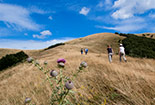
This grassy area offers us a panorama of almost 180 degrees, from south-east to west. The entire Pratomagno massif marks the horizon from south to south-west. From up here we have a clear idea of the course of the Arno heading towards Arezzo, in the Casentino valley floor we can distinguish the hills of Romena and Poppi with their castles. Further on we see Bibbiena; further to the left, at the top, there is the unmistakable mountain of La Verna. Near the lowest part of the meadows,
 the CT4 turns right and after a few tens of meters turns left, where a steep descent begins towards the Vitareta refuge. We go straight on entering the CAI path 3 which begins at this point. In fifteen minutes, inside a beautiful beech wood, it leads us to the Lake of Idols which appears suddenly. We are at 1380 meters above sea level, a history of two thousand five hundred years, makes this place give us an unusual, unexpected charm. We talk about it in detail on page 42 of those in succession.
From Lago degli Idoli, the CAI 3 in twenty minutes of pleasant ups and downs in the forest leads us to Capo d'Arno (1358 meters), a place of Dante's memory mentioned by the Supreme Poet in the 14th Canto of his Purgatory.
Here we leave the CAI 3 path to follow CAI 17 which in half an hour of walking with a prevalence of a slight climb takes us to the 1406 meters of Passo delle Crocicchie, the intersection we arrived at when descending from the top of Falterona with GEA 00.
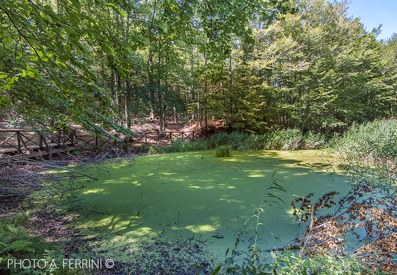
From this pass we continue the path on the CAI 17 which descends with a moderate slope, in fifteen minutes we reach the Black Gorga (1280 m). The name originally identified a large basin on the north face of Falterona, where there was a deep crack full of water. Today, this name refers to a small pond. In this place, history and legend come together, you don't know where one ends and the other begins. "The Devil's Barn Owl", a disturbing story by Emma Perodi, is set in this basin of a thousand mysteries. We describe this place in detail on page 52 of those in succession.
Resuming the journey on CAI 17, in twenty minutes we go down to the Fonte del Borbotto where we find a large area equipped with tables and benches in the lawn and in the woods. The place is a cool oasis for the inhabitants of Mugello, and also comfortable since we can arrive by car a few meters from here. The spring does not grumble, as we would have expected, but its water is fresh and excellent.
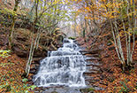
 If we go down a few hundred meters along the driveway that leads to Castagno d'Andrea, we will have an interesting view of the basin on the mountain formed with the great landslide of 1335. We will also find the beginning of the CAI path 14c, named after Enrico Boni, which in about 1.5 kilometers leads to the Piscino Waterfall, under the Balze delle Rondinaie. Certain sections of the path must be followed with care and caution.
From Fonte del Borbotto we begin to go up the forest road which in this first section coincides with CAI 16. We are covering the last four kilometers of the itinerary, constantly uphill but not demanding. After five hundred meters the CAI 16 turns right to climb towards the top of Falterona, we continue on the forest road which from here on coincides with CAI 8.
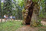
A little further on we find the Poggiolino Rosso viewpoint. Among lush beech trees there are some tables that offer the opportunity to comfortably enjoy a sandwich in front of a spectacular view. Less than two kilometers and we will see, at the top, on the left of the road, a cliff among the beech trees. To the right of the path, however, there is a beautiful forest where large boulders are scattered. This place recalls the Sacred Forest of La Verna at the foot of the mountain of Dante's memory, so dear to San Francesco. Another kilometer and a half and we are at Passo di Piancancelli, where we left the car.


