Sulla via del ferro e della transumanza
itinerario sulle pendici sud Pratomagno da Pontenano al Passo della Crocina
Italiano
IN CAMMINO SU UNA VIA DELLA TRANSUMANZA 17
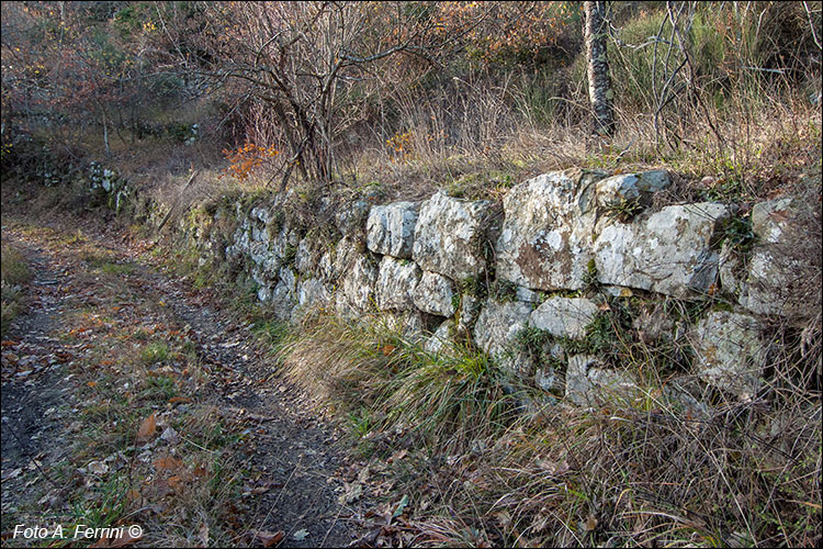
Fatti circa 250 metri per la strada nel bosco che in diversi punti presenta un evidente selciato, iniziamo a trovare delle mura lungo la strada. Non sono i tipici muri a secco fatti dai contadini. Questi presentano pietre enormi e anche squadrate. Ci ricordano il muro visto al Torrione poco prima. Di questi manufatti in pietra ce ne sono tanti, a pochissima distanza tra loro. Ce ne sono anche sotto strada, con pietre ancora più grandi e squadrate, ma questi è difficile vederli. Ne vediamo anche altri abbarbicati sulle scoscese pendici monte alla nostra destra. E lassù, poco più in alto, ci sono i resti dell'antica torre vista in precedenza. Se tutto questo lo uniamo al toponimo Castellaccio (nome con cui è chiamata in loco la zona dove ci troviamo) ci è facile intuire che qui ci fu un luogo fortificato. In funzione del castello di Pontenano a 500 metri da qui? Forse, ma ci fu altro.
After about 250 meters on the road in the woods which has stone paving in several places, we begin to find walls along the road. They are not the typical dry stone walls made by farmers. These feature huge and also square stones. They remind us of the wall seen at the Torrione shortly before. There are many of these stone artefacts, very close to each other. There are also some under the road, with even larger and squarer stones, but these are difficult to see. We also see others clinging to the steep mountain slopes on our right. And up there, a little higher up, there are the remains of the ancient tower seen previously. If we combine all this with the toponym Castellaccio (name by which the area where we are located is called locally) it is easy to understand that there was a fortified place here. Based on the castle of Pontenano 500 meters from here? Maybe, but there was more.


