From the small village of Capraia to Santa Trinita
the path from Capraia to Badia Santa Trinita and possible return on two different routes
Texts and photos by Alessandro Ferrini ©
95 images in sequence to learn about this itinerary in Pratomagno. Click to start the virtual excursion
To the Abbey of Santa Trinita from the characteristic village of Capraia
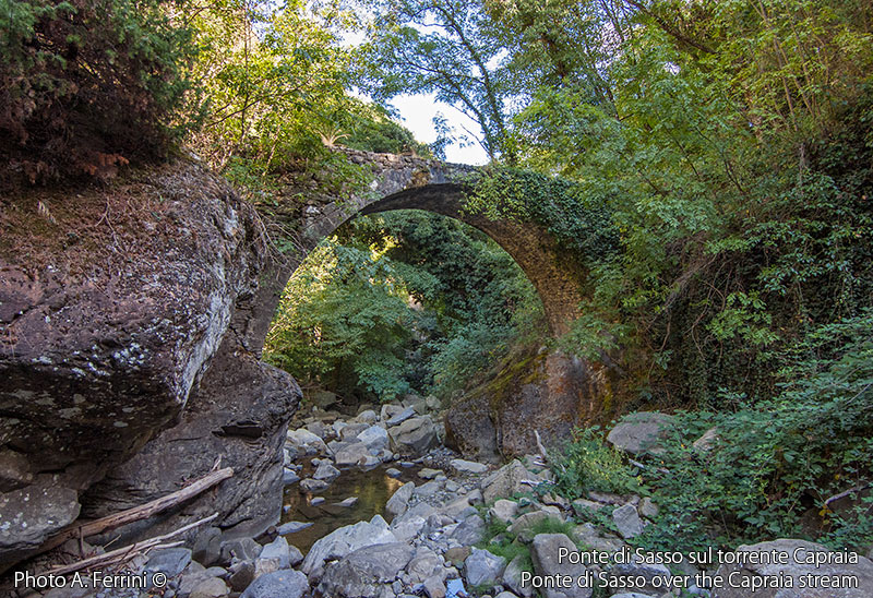
 In this web section we describe two itineraries that start and finish in Capraia, a small village in the municipality of Talla at 638 meters above sea level. Both routes are approximately 10.5 kilometers long and, initially following the CAI 32, in 4.5 they reach the ruins of the Abbey of Santa Trinita in Alpe (952 m). From here the first route heads to Fonte Cavallari and then descends to Ponte di Sasso from where it goes back up to Capraia on a steep path. The second itinerary from Santa Trinita goes up to Passo alla Forca where it enters a forest road that heads to Faltona. After a kilometre, leave this road to take another which goes down to Capraia. The two itineraries have an almost equal total altimetric variation. The first is 900 meters, the second 950. Both are considered to be of medium physical effort. Which one to choose between the two? The first will make us walk through the most beautiful woods, in particular chestnut groves where we will see centuries-old plants. We will cross some waterways, the last of which has a medieval bridge. The second itinerary, however, climbing higher will show us wide panoramas, over Arezzo and towards the Casentino.
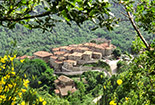
Capraia is six kilometers from Talla. It is the same road for Pontenano and after four kilometers, however, (five hundred meters before Pieve Pontenano) we have to turn right. The small village is perched on the rocks of a cliff almost overlooking the stream below. The perimeter of the town corresponds to the external walls of what was the Capraia Castle destroyed in 1502 by the troops of Vitellozzo Vitelli, Lord of Città di Castello and captain of fortune. Capraia probably began to be reborn as a town after a century, but there are no documents attesting to this. The "building" area was delimited by the external walls of the medieval castle. To have as much space as possible for housing, the internal alleys had to be narrow, exactly as they are today. Due to these characteristics, the small village of Capraia is considered the "architectural gem" of the Municipality of Talla. In certain points of the town we clearly see how the walls of the current houses have those of the ancient castle as their base. In the lower part of the village there is the most evident evidence of the Capraia Castle: a sort of semicircular tower leaning against a building, locally the area is called "Le Mura".
Walking inside the town we notice how well-kept the houses are, despite today there are only about ten permanent residents (a census of 1833 showed 186 inhabitants). We pass in front of the "people's oven", it was lit once a week and bread was baked for the whole community. Our attention is attracted by some shelves
 made of stone slabs and placed next to the windows of some buildings. The first thought is that they served as a support for flower pots. Not exactly, the chamber pot was kept there!
Despite being a small village, Capraia has an interesting artistic aspect. In the church dedicated to Santa Maria there is a valuable Madonna with Child in polychrome terracotta dating back to the end of the 15th century. The work belonged to Badia Santa Trinita, the moment in which it was moved to Capraia is unknown, it is assumed in the 17th century when the abbey was already in a phase of decline. A tragic fact and a legend are linked to this Madonna which we talk about on pages 83 and 88 of the sequence.
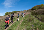
We begin our excursion from the external square in Capraia, where there is a car park. We head towards CAI 32, on our right observing the town. We will return from here if we take the route that passes through Fonte Cavallari and Ponte di Sasso, while we will arrive from the road that goes down behind us if we pass through Passo alla Forca. In two hundred almost flat metres, we reach the small cemetery of Capraia. The CAI 32 which leads to Santa Trinita continues to the right of this. Going left, and after fifty meters left again, in five hundred meters we will descend to the Ponte di Sasso. For a few hundred metres, CAI 32 rises slightly and flows between small fields now hidden by vegetation, real plots of land where for a few centuries the inhabitants of Capraia have cultivated products that are indispensable to their family economy. At a hairpin bend to the right, the route enters the actual woods and begins to climb more steeply. CAI 32 has become a path, in some sections it is also paved because it had to allow the passage, even with wet ground, of animals such as donkeys and mules to bring wood and coal to Capraia. The vegetation we will encounter is suitable for stony and arid soil, we will find some chestnut trees at the beginning, but mainly oak and many bushes. On the other hand, we are on the steep and rocky slopes of a mountain facing south-west, a place for goats, as the toponym clearly tells us, not suitable
  for sheep which instead need flatter and grassier spaces to graze. These considerations make it clear that the route is not advisable in the central hours of summer days.
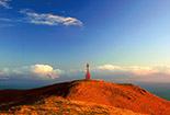
After a couple of kilometers from Capraia we will cross an area almost devoid of tall vegetation where we will walk between bushes and on spectacular rocks (a stretch that is absolutely not annoying for those who suffer from vertigo). We find ourselves on the so-called "Coste del Picchio" (pages 25 and 26 of the sequence) which offer wide views towards Pratomagno, the valley floor and the mountain in front, much cooler and with vegetation consisting of lush chestnut, beech and fir forests . We will pass you in a few kilometers. After passing the "Coste del Picchio" we return to the woods and then cross a dense fir forest at the end of which we find the "Fonte della Badia". A few meters further on, the CAI 32 crosses the CAI 44 which on the right goes up towards Passo alla Forca (the route we describe last), on the left it reaches the ruins of Santa Trinita in a few tens of meters and in a couple of kilometers Fonte Cavallari. Now let's go in this direction.
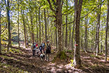
We reach the ancient abbey from its rear part, so we find ourselves next to the apse, an architectural element almost completely rebuilt during a major recovery work on the religious complex carried out in 1970. We move to the front part of the building from where we see account of the size of this church with three naves and a Latin cross plan. It was founded around 960 by two German monks, Peter and Eriprando, it is said at the direct behest of Otto I of Saxony. Much more information on this place is reported in the itinerary that arrives here from Pontenano. https://www.ilbelcasentino.it/pontenano-santa-trinita-en.php We continue on CAI 44 which in two hundred meters descends to the small wooden bridge that takes us across the Fosso della Badia. From the Santa Trinita source to here we walked on CAI routes 32 and 44 which run overlapping. Twenty meters after the bridge, the first continues straight, going up. We turn left following the CAI 44 which enters the Selva della Badia, a lush chestnut grove that for centuries was synonymous with food for those who lived in the Badia. Today the centuries-old chestnut trees of this forest have almost disappeared, we find some particularly majestic beech and fir trees.
In five hundred meters we reach the Fosso della Specchiana. Before crossing it we can descend about thirty meters (if we feel up to it and the earth is not too wet) along its left bank.
  We will admire the wonderful pavement on which the watercourse flows. Once we have crossed the ditch, however, we can go for fifty meters on the road on the right. We will find a small waterfall, but very choreographic due to the movements of the water on the rocks. Back on CAI 44 we will walk for about a kilometer before arriving at a barrier that closes the forest road to motorized vehicles coming from Pontenano. Beyond the barrier, a stupendous chestnut forest begins above the road (one hundred and fifty meters further on, also under the road), with some beech trees, which will take us up to Fonte Cavallari (about seven hundred metres), an unmistakable place due to the presence of two buildings . Facing the road on the right that goes up to a house, we leave the CAI 44, which continues towards Pontenano, to take, on the left, a forest track that descends quite steeply for a few dozen metres. A beautiful chestnut forest continues to accompany our journey. After 450 meters the forest road splits (further on it reunites). We go right following the flatter route. We will enter a chestnut grove where there are still centuries-old plants that we cannot help but stop to admire their majesty. The forest tracks come together and a little further down we arrive at a clearing with a crossroads. We continue keeping to the right. After a couple of kilometers on this road which took us through the Fosso del Pratolino and the Fosso del Vado, thirty meters before the Fosso di Carbonaia, we have to take a forest track on the left. In five hundred meters this reaches a crossroads where we must continue to the left. In two hundred meters we arrive at the Ponte di Sasso, a round arch structure of medieval origin that takes us across the Capraia Torrent, a continuation of the Fosso della Badia. A watercourse that in the three hundred meters upstream from the bridge shows us a stupendous conformation: there are real natural pools among rocks with the most particular shapes. Beyond the bridge, our route begins to climb a steep path between the rocks, in some places the ancient pavement is still present. Higher up we enter, turning left, onto a less steep path which in a few minutes leads us to the small cemetery of Capraia, another two hundred meters and we will be in the village.
Now we describe the second return route from Santa Trinita to Capraia. We are once again at Fonte della Badia,
  but this time, after seeing the abbey, we follow the CAI 44 towards Passo alla Forca (1065 metres) which we reach in seven hundred meters on a narrow and steep path, especially at the beginning. At Passo alla Forca the CAI 44 joins the CAI 40 which coincides with a forest road that runs along the ridge of this mountain. We have to go right towards Faltona and Capraia, but first we go three hundred meters to the left. They are enough to climb a little and from a right bend with a concrete surface we will be able to enjoy a beautiful view of Arezzo and the area surrounding the city. Returning to Passo alla Forca we continue on CAI 40. After two hundred metres, near Poggio Gangari, we will have wide views towards the Casentino, with the Apennine ridge and the unmistakable Monte della Verna marking the horizon. A little further along the road we find a religious shrine, we talk about it on page 88 of the sequence. A few more hundred meters and we arrive at a crossroads. CAI 44 keeps left to head towards Castelnuovo di Faltona. We turn right, downhill, still on a forest road open to motorized vehicles which in just over four kilometers takes us back to Capraia. After two hundred meters we arrive at a crossroads where we go right. This route runs through forests of pine, chestnut, oak and other tree species. The dense vegetation does not allow for particular views. Six hundred meters before Capraia we find another crossroads. The road on the left, which goes up, leads to Faltona, we continue to go down and in a few minutes we will be back at the starting point of our excursion.


