Un’escursione alla Gorga Nera nel Monte Falterona
un itinerario nel Parco Nazionale delle Foreste Casentinesi
Italiano
UN RAMO DELL’APPENNINO
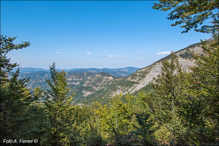
Poggiolino Rosso, nonostante si trovi a una quota non particolarmente elevata, 1258 metri, offre uno straordinario panorama verso nord-est. In particolare, da qui abbiamo una vista sull’Alpe di San Benedetto che rende bene l’idea sulla conformazione di questo ramo della dorsale appenninica che dalla zona di Piancancelli raggiunge il Passo del Muraglione. Il suo nome deriva dall’omonima abbazia benedettina che si trova non lontano da questo storico collegamento tra Toscana e Romagna. La parete rocciosa nella montagna, a destra nella foto, sono le Balze delle Rondinaie. Con la strada forestale che stiamo percorrendo, tra un paio di chilometri gli passeremo abbastanza vicino. Il complesso montuoso dell’Alpe di San Benedetto, di cui fanno parte anche i Monti Falco, Falterona e la Fonte del Borbotto, ha un’estensione di oltre 1700 ettari e ricade quasi interamente nel Parco Nazionale delle Foreste Casentinesi, Monte Falterona e Campigna. Poggiolino Rosso, despite being at a not particularly high altitude, 1258 meters, offers an extraordinary panorama towards the north-east. In particular, from here we have a view of the Alpe di San Benedetto which gives a good idea of the conformation of this branch of the Apennine ridge which from the Piancancelli area reaches the Muraglione Pass. Its name derives from the Benedictine abbey of the same name which is located not far from this historic connection between Tuscany and Romagna. The rocky wall in the mountain, on the right in the photo, is the Balze delle Rondinaie. With the forest road we are traveling on, in a couple of kilometers we will pass quite close to it. The mountainous complex of the Alpe di San Benedetto, which also includes the Falco, Falterona and Fonte del Borbotto mountains, covers an area of over 1700 hectares and falls almost entirely within the National Park of the Casentino Forests, Monte Falterona and Campigna.


