Da un castello dei Guidi a un’abbazia benedettina
itinerario sul Pratomagno da Trappola alle Tre Punte, a Santa Trinita e alla Bottigliana
Italiano
ITINERARIO TRAPPOLA – MONTE LORI – BADIA SANTA TRINITA 69
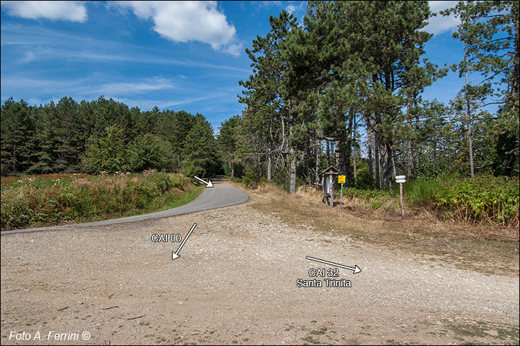
Finito di discendere il colle, il CAI 00 esce dal bosco e s’immette sulla strada asfaltata. Vi cammineremo per un centinaio di metri, poi la lasciamo per entrare in questo grande spiazzo spesso utilizzato come imposto di legname. Siamo al Varco di Anciolina, a 1150 metri di quota, un luogo che è stato di particolare importanza per la viabilità del Pratomagno. È molto probabile che in questo punto la montagna fosse attraversata da un’importante direttrice romana, o addirittura etrusca: la Via Abversa. Spieghiamo nella pagina seguente sulla base di cosa può essere fatta questa ipotesi. Once you have finished descending the hill, the CAI 00 exits the woods and joins the asphalt road. We will walk there for a hundred meters, then we leave it to enter this large clearing often used as a timber yard. We are at the Anciolina Pass, at 1150 meters above sea level, a place that was of particular importance for the road network of Pratomagno. It is very likely that at this point the mountain was crossed by an important Roman, or even Etruscan, route: the Via Abversa. We explain on the following page on the basis of what this hypothesis can be made.


