Byzantine Way in the Municipality of Talla
Walk between Casentino and Valdarno to discover evidence of this ancient civilisation
Texts and photos by Alessandro Ferrini ©
90 images in sequence to learn about this itinerary in Pratomagno. Click to start the virtual excursion
Campovecchio: Byzantine evidence. A walk to discover them
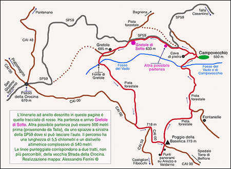 In this section we illustrate a circular itinerary of 5.5 kilometers and a total altitude difference of 540 metres. Then we have to add five hundred meters to visit a splendid place, the main reason for this walk. It is therefore a route of low physical effort for trekking lovers.
From Talla, going up towards the Crocina Pass, after 4.7 kilometers we find an indication on the left: Campovecchio. Everyone has seen it, everyone knows that this place exists, very few have been there, no one knows what extraordinary architectural, historical and religious peculiarities it can show. It is a small village at 550 meters above sea level which is now uninhabited, but until the 1960s fifty-five people lived there. The buildings present can be dated from the second half of the eighteenth century to the twenties of the following century. The origins, however, are much older: the apse of the present church is clearly Romanesque in style and the place was certainly fortified, in a document from 1384 it is cited as "Castrum Campivecchi". Then, visiting it, we will realize that it is plausible to go much further back, up to the 7th and 8th centuries. On the other hand, if we have called the route we are about to describe the "Byzantine Way", there must be a reason.
The road that follows the Campovecchio sign is private, as is the place which is still allowed to be visited. To do this, however, we recommend continuing another three hundred meters on the Strada della Crocina (SP59). On the outside of a right curve there is another road, without signs, which in three hundred meters descends to Campovecchio (not accessible by car which we can park two hundred meters further on in an open space to the left of the SP59). There is another reason why we recommend doing this route: it is a stretch of the old Strada della Crocina. In the cadastral maps of the 1930s it is still indicated as Via Valdarnese. The current SP59 that we took by car to get from Talla to here did not appear until at least the 1870s. We will talk about this topic again later, as well as about Campovecchio, at the end of the description of the itinerary which will take us walking through woods of various types and will show us views of Arezzo, Valdarno and Casentino.
From the Campovecchio sign we continue by car on the SP59 for another kilometre, up to a building in dilapidated condition on the left of the street, commonly known as Gretole di Sotto (we will find the historic site of Gretole after a
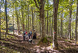
 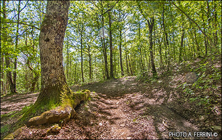 few minutes' walk). Here there is space to leave the car. Eighty meters beyond the building there is a forestry track that crosses the SP59, it is still the old Strada della Crocina. We will begin our journey on the route to the left, a road that has lost its original characteristics because it has become a forestry track. After three hundred meters of climb the route forks. We can continue on the easier forest track. We recommend, instead, going right. In doing so we will walk on an original stretch of the old Strada della Crocina, here bordered by a dry stone wall. High above the wall, we see a large building: it is Gretole. After the building, the road becomes flat and runs past majestic oak trees. In less than a hundred meters we arrive at a crossroads where the old Strada della Crocina turns right (it is still passable for 150 metres), we go left and in a few steps we return to the forestry track left shortly before. From here, in a couple of minutes we go down to the Fosso del Vado where a path on the right in twenty meters leads to the Fonte di Gretole. Beyond the ditch we go up for a short distance. We are entering what from a vegetative point of view is the most beautiful stretch of the itinerary. The forest is mixed with a prevalence of oak, some of these plants are real natural monuments. This forest track, which alternates flat sections with slight climbs, leads to the crest of the mountain where the CAI 00 del Pratomagno flows which we take by turning left. From Gretole to here we traveled 1.5 kilometres. Even the CAI 00, which from the highest peaks of the massif heads towards Spedale and the Belfiore Tower in the Municipality of Capolona, follows a forestry path. In two hundred and fifty meters of pleasant ups and downs it leads to the crossroads with the CAI 53 (718 m) which descends to the ruins of the Pieve di San Quirico and then to Castiglion Fibocchi.
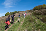
We continue on CAI 00. Although short, the most challenging stretch of the itinerary begins here. In three hundred and fifty meters we will reach the top of Poggio della Basèlica (773 m). During this climb (the first part is the steepest and has a stony surface) let's not forget to look back. On the mountain in front of us we will see Pontenano, above, and Capraia, on the right. On the top of Poggio della Basilica we find, on the left, the forestry track which in 1.6 kilometers will lead us to Campovecchio. Before setting off on this new road we recommend traveling another twenty meters on CAI 00 and then another eighty to the right. We will reach a panoramic point, to the left,
 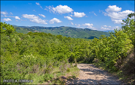 which offers us a beautiful view of Arezzo and, if there is no mist, our gaze will be able to penetrate the Valdichiana. Do we want to see more? We continue for another hundred meters and our view will extend over the Valdarno.
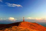
This is what Poggio della Basèlica offers, whose toponym most likely dates back to the period in which this part of Italy was disputed between the Lombards and the Byzantines (7th-8th century). This term is often found along the strip of territory that divided these two civilizations. The toponym can be attributed to the Byzantines, together with other traces not far from here: saints of oriental devotion such as San Mamante (today Santa Mama), Sant'Eleuterio (today Salutio), Sant'Apollinare to whom the church of Campovecchio is dedicated, which we are about to reach, and another in the Il Santo area, in the Municipality of Capolona.
Having observed the views, we go back and take the forest track that leads to Campovecchio. Initially the route is almost flat, after a couple of minutes of walking it begins to descend and in front of us we have a wide view towards the Casentino favored by an airy oak forest which has recently been cut down. The unmistakable Monte della Verna will be a constant reference on the horizon. Even from here, on the left, it is possible to see Pontenano and Capraia. After six hundred meters of constant descent we reach a crossroads with another forestry track. One kilometer to go to Campovecchio. We go left and with another seven hundred meters of descent we arrive at the Fosso del Vado, or Fosso di Campovecchio. Beyond the watercourse we face the last stretch of the itinerary: three hundred meters on a non-demanding climb. After forty meters, however, we recommend taking a few steps into the woods, on the right. From here begins the visit to the many particularities that Campovecchio has to show us. Dug into the ground, there is a large basin surrounded by a dry stone wall. It is the so-called "Salto della Pecora", here the sheep were washed before shearing. When there was an opportunity, the natural pools of ditches and streams were exploited. Campovecchio didn't have any and so a special pool was built, however along a ditch so that it could be filled with water with a simple pipe. Back on the forest track, in five minutes we reach Campovecchio.
The forestry path ends in front of two former stables. On the left we see two roads arriving, they are the ones we saw coming down from the SP59. The first is the historical one, the old Via della Crocina. We will use it to
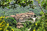
 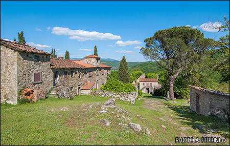 return to the car which is one kilometer away. Now let's go right, onto the road that descends along a meadow and between the buildings that make up the small village of Campovecchio. The oldest part, the one that was fortified, is located at the end, two hundred meters from here. The road we are walking on is the continuation of the historic one that descends from the SP59, on a map from 1825 it is indicated as "Via che va a Talla". Immediately on the left there is a large building, it is the main house. Antonio Forzoni lived here until 2017 and left us at the age of 95 (the Forzoni family, originally from Anciolina, purchased this place in the mid-17th century). As soon as you pass the building, the street that went to Talla turns left. Its path, next to a wall, is still evident. We continue straight and after passing two other houses, on the right, we find ourselves next to something of high historical, architectural and archaeological value: the base of a tower with a circular section, a style that refers to Byzantine Ravenna. In Casentino there is another with this shape: the bell tower of Pieve a Socana. We will have another clue that Campovecchio experienced the Byzantine civilization after continuing fifty meters further: we will find an elegant church dedicated to Sant'Apollinare, a reference figure in the religiosity of the Byzantines and Eastern Christianity in general. If we add to this the Poggio della Basèlica, which we passed earlier, we can certainly say that we are in an area of Byzantine dominion.
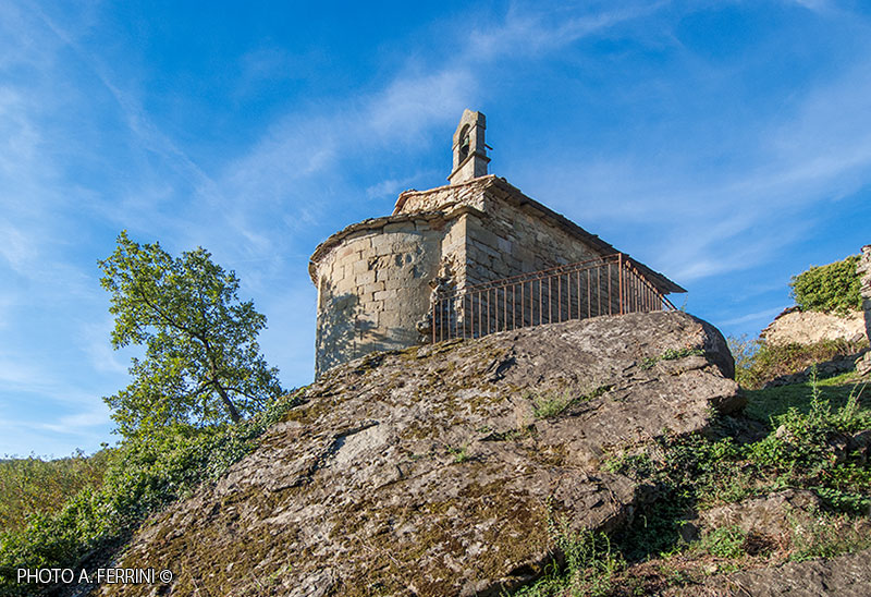
Looking at the apse of the church, clearly Romanesque in style, the sacred building can be dated between the end of the 12th and the beginning of the 13th century. The facade, however, takes us further forward, probably to the end of the 14th century. The lunette above the door has an unmistakable Gothic style. It is probable that this part of the building was rebuilt by the Ducci family whose coat of arms is found on the corner of the church located on the top of an enormous rock which certainly served as a natural fortification of the place at this point. The interesting interior of the church, which can only be visited in the presence of the owners, is shown in the sequential pages of this section, as well as other particularities of Campovecchio. Moving next to the apse we have a beautiful view towards the Casentino with Monte della Verna on the horizon. It is possible to go down to the foot of the large rock where the
 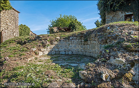 church is located which becomes fascinating with this view from below. We go down a few more meters and find another pit in the ground, very different from the one seen along the Fosso del Vado. This, quadrangular in shape, has an open side and the bottom is paved with stone slabs. It was a kiln for the preparation of lime, a material which, given the quantity of buildings present, must have been used a lot.
We go up the village of Campovecchio, at the former stables we take the historic road. After one hundred meters there is a deviation to the left which in a few steps leads to an ancient stone quarry. On the left side of this there is a darker, clearly harder material, while at the top we see a yellowish color. There is the limestone there that was fired in the kiln seen just below the church. Once back on the road, in two hundred meters we arrive at the SP59 on which we turn left (the old Strada della Crocina continued straight ahead, where today we only see the woods). After two hundred meters, halfway along a straight stretch of the SP59, there is an open space on the left. It is the one we recommended as a car park in case we only wanted to visit Campovecchio, but it can also be another starting point for this walk, as indicated on the map. At the end of this clearing, to the right of the road, there is a sloping field. In the upper part of this (from where we can have a beautiful view of the Alpe di Catenaia and La Verna) the old Strada della Crocina passed, of which only a few traces remain in the woods. On the opposite side, however, we see some mountains, the one furthest to the left is Poggio della Basèlica. We continue our journey on the asphalt road, in five hundred meters we arrive at Gretole di Sotto, the starting point of this non-demanding hike.
The walk is over, but at this point, in a few minutes by car, we can go and visit another thing no less interesting than what we have seen so far. If during the walk we have learned about Byzantine evidence, we will now enter Lombard territory. From Gretole di Sotto, the starting and finishing point of the walk, we descend the Provincial Road 59 for 3.7 kilometres, until we reach a 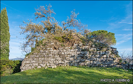 crossroads on the left indicating Santo Bagnena (2 km fron Talla). We take it and in five hundred meters we reach the first location, here in the small square overlooks the church dedicated to San Michele Arcangelo, the religious figure of reference for the Lombards. The slab roofing (it looks like a trullo) of the small dome behind the altar is curious. We continue and the narrow municipal road eight hundred meters leads us to Bagnena, a town built where there was a sumptuous medieval castle. There is very little historical information on the place, certainly the area was under the dominion of the bishopric of Arezzo. But this matters little to us, instead we admire this small village in the municipality of Talla. The entrance door is still that of the castle, with a truly impressive thickness of the walls. We enter, climbing, into this characteristic place and after a hundred meters we find the remains of a tower which is something incredible for what its size could have been and for the dimensions and workmanship of its stones. A few meters from the tower, towards the east, we have a wide panorama. Below us we see the Saint, from which we passed earlier, further down is Talla. The horizon is marked by the unmistakable Monte della Verna. In front of this, slightly moved to the right, we see a hill characterized by a pointed shape: it is Monte Acuto, located between Talla and Salutio. Precisely on this peak are the remains of another castle.


