Cammino Bizantino nel Comune di Talla
Passeggiata tra Casentino e Valdarno per scoprire testimonianze di questa civiltà
Italiano
PASSEGGIATA IN UN TERRITORIO BIZANTINO 70
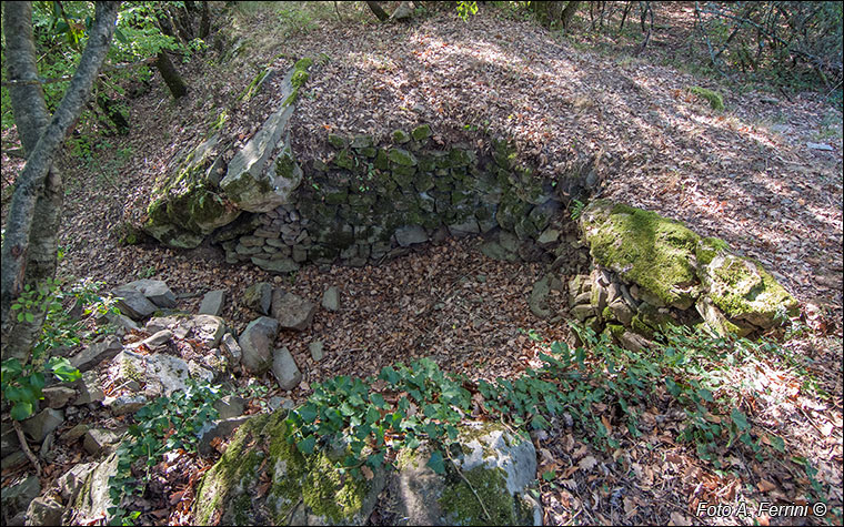
Dal punto che ci ha permesso di osservare dal basso la chiesa di Campovecchio, un vialetto tra le piante ci conduce in poco più di dieci metri a questa fossa cinta da un muro a secco, aperta su un lato e con fondo pavimentato con lastre di pietra. La sua forma è ben diversa dalla vasca per il "salto della pecora" vista vicino al Fosso del Vado (pag. 40). A cosa poteva servire? Fu sicuramente una fornace per la produzione di calce. Visto quanti edifici saranno stati costruiti a Campovecchio nel corso dei secoli (attualmente ce ne sono 2200 metri quadrati, compresi i ruderi) di calce ne deve essere servita tanta. Nel proseguo della passeggiata vedremo anche la cava che forniva la pietra adatta a questo scopo.
Ora iniziamo a risalire il vecchio borgo sulla strada già percorsa.
From the point that allowed us to observe the church of Campovecchio from below, a path among the plants leads us in just over ten meters to this pit surrounded by a dry stone wall, open on one side and with a bottom paved with stone slabs . Its shape is very different from the "salto della pecora" pool seen near the Fosso del Vado (page 40). What could it be used for? It was certainly a kiln for the production of lime. Given how many buildings have been built in Campovecchio over the centuries (there are currently 2200 square metres, including the ruins) a lot of lime must have been used. As we continue the walk we will also see the quarry that provided the stone suitable for this purpose.
Now we begin to go up the old village on the road already travelled.


