Cammino Bizantino nel Comune di Talla
Passeggiata tra Casentino e Valdarno per scoprire testimonianze di questa civiltà
Italiano
DOMINIO VISIVO VERSO IL CASENTINO
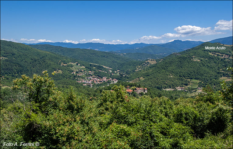
La torre del Castello di Bagnena si trova a circa seicento metri di quota. Altezza non particolarmente elevata, ma dalla quale abbiamo uno straordinario panorama, quasi a trecentosessanta gradi. La foto ci mostra la vista sicuramente più bella e interessante, quella verso il Casentino. Sotto di noi vediamo Santo Bagnena, da dove siamo passati. Il paese più lontano e il basso è Talla. L'orizzonte è segnato crinale appenninico dove, da sinistra a destra, distinguiamo il Monte Falterona, il Passo della Calla, la Giogana con Poggio Scali, Poggio Spillo tra Camaldoli e Badia Prataglia. Con le due montagne più lontane siamo visivamente a Poggio Tre Vescovi. Appena più a destra vediamo l'inconfondibile Monte della Verna e poi l'inizio dell'Alpe di Catenaia. Il monte dalla forma appuntita, poco a destra della Verna e più vicino a noi è Monte Acuto, posto tra Talla e Salutio. Sulla sua cima, probabilmente nel XIII secolo, fu costruito un castello poi distrutto nel 1502 da Vitellozzo Vitelli, capitano di ventura e Signore di Città di Castello. Oggi sono rimasti pochi ruderi, comunque affascinanti. Vediamo qualcosa nella prossima pagina.
The tower of Bagnena Castle is located about six hundred meters above sea level. Not a particularly high height, but from which we have an extraordinary panorama, almost three hundred and sixty degrees. The photo shows us the most beautiful and interesting view, the one towards the Casentino. Below us we see Santo Bagnena, where we passed. The furthest and lowest town is Talla. The horizon is marked by the Apennine ridge where, from left to right, we distinguish Monte Falterona, the Passo della Calla, the Giogana with Poggio Scali, Poggio Spillo between Camaldoli and Badia Prataglia. With the two furthest mountains we are visually at Poggio Tre Vescovi. Just further to the right we see the unmistakable Monte della Verna and then the beginning of the Alpe di Catenaia. The pointed mountain, just to the right of La Verna and closest to us is Monte Acuto, located between Talla and Salutio. On its top, probably in the 13th century, a castle was built and then destroyed in 1502 by Vitellozzo Vitelli, captain of fortune and Lord of Città di Castello. Today there are few ruins left, but they are still fascinating. Let's see something on the next page.


