From Monte Lori to Cima Bottigliana
an itinerary in Pratomagno, the massif between Casentino and Valdarno
Texts and photos by Alessandro Ferrini ©
70 images in sequence to learn about this itinerary in Pratomagno. Click to start the virtual hike
In Pratomagno from Monte Lori to the Spada nella Roccia and the Cima Bottigliana.
 The itinerary in the Pratomagno described here has its starting point in the most famous and popular place in the southern part of the great massif: Pian di Lavacchi, better known as Prato di Monte Lori, 1250 meters above sea level. This is also the starting point for what is considered the most classic excursion in Pratomagno: reaching the famous cross while staying on the mountain ridge, about seventeen kilometers, round trip. With the route we describe, we will arrive at Cima Bottigliana, 1450 meters, not even halfway to the cross. The itinerary, however, includes two small loops that will allow us to discover natural and landscape aspects of particular beauty.
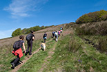
The length of the route is about nine kilometers, its height difference is not two hundred meters as it might seem from what is written above. The excursion, in fact, mostly follows the ridge of the massif which is made up of many hills in succession. The outward journey will have a positive difference in height of about three hundred and sixty meters, the return one of one hundred and fifty meters. The elevation changes are well distributed over the entire route, with no particular uphill or downhill sections. A walk, therefore, of little physical effort.
At Pian di Lavacchi we start walking on the CAI 00 crossing the large lawn which in the summer is crowded with many people. Entering a beautiful beech forest, after a few meters we cross a path on the left (barely visible). It is the CAI 49A that we will take on the way back. A little further on the road begins to rise more decisively, but not demanding.After fifteen minutes of walking, where the climb becomes less demanding, the CAI 49 comes from the left which we will take on the return, but we immediately describe its path even if it is the final one of the itinerary proposed here. After passing by Monte di Loro, the path leads to the top of a cliff: Le Tre Punte, at 1290 meters above sea level. The CAI section of Arezzo has built a climbing wall: the Roman Nesi Ferrata. From here we will have a spectacular panorama towards the southwest. We will see the Valdarno, Arezzo, the Valdichiana. At the bottom of this, with a clear atmosphere, Lake Trasimeno is visible. Monte Amiata marks the horizon. After enjoying this spectacle and the suggestion of the overhang, we go back on CAI 49. We meet a crossroads, we had arrived from the left, now we go to the right entering the CAI 49A which in twenty minutes walk, first panoramic, then inside the woods, takes us back to Pian di Lavacchi. We preferred to immediately describe this path because it can also be a short loop itinerary (about 3 kilometers) in its own right, always with the same starting and ending point.
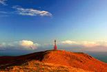
We resume the itinerary that we had proposed starting from the intersection between CAI 00 and CAI 49. With another five minutes of walking we reach a clearing: we are on the top of Monte Lori, 1380 meters. From here we have a view of the Pratomagno massif up to the cross. CAI 00 begins to descend steadily, alternating sections where it passes through shady beech woods with others where it crosses clearings that in the summer are covered with many varieties of flowers.
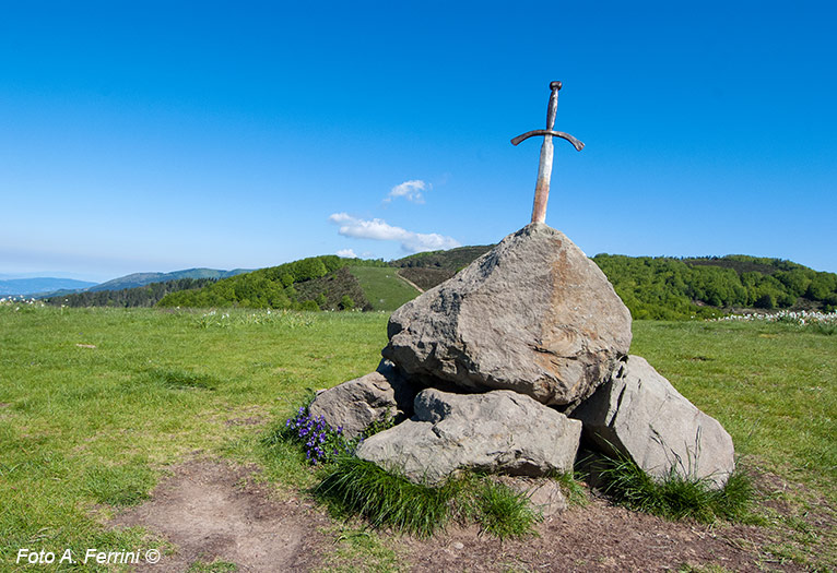
 After about twenty minutes we went down to a plateau at 1320 meters above sea level, here we find a crossroads. CAI 24 starts on the left and leads to Trappola. CAI 00 continues straight. We go on the right path that climbs the hill of the Sword in the Rock. This point of Pratomagno is certainly the place that offers us the greatest variety and quantity of flowers in the entire massif. In the second half of May a large part of this hill turns white due to the many daffodils that bloom there. Walking around it means feeling enveloped in a white and fragrant cloak. At the top of the hill (1360 meters) there is a heap of large stones. A sword is stuck on the top one. The idea is certainly not original, but it is nice and the place has become a point of reference in the Pratomagno.
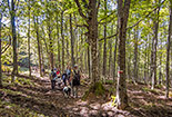
We descend the hill on the opposite side, in front of us another one immediately appears. In the saddle between the two we find the CAI 00 which comes from our left and begins to climb heading towards Cima Bottigliana. This peak is part of our itinerary, but we will use another route to reach it. We then leave the CAI 00 to take the CAI 38 which starts from this point and enters a beautiful wood. The new path takes us along a pleasant ups and downs among beautiful beech trees. After ten minutes of walking, just before a gate, we find a detour to the right which in two hundred meters of slight descent leads us to a plateau where the Casetta del Conforto is located. Today it is a refuge for walkers, once it was a refuge for woodcutters and shepherds. The place is equipped with tables, so it can be a good stop for rest and refreshment. Back on CAI 38 we continue the path to the right and after a few meters we find the aforementioned gate. Beyond this the CAI 38 immediately turns right, we continue straight on a forest road that in three hundred meters between beech and fir trees leads us to CAI 36 which comes from Carda. Entering this new path, we will go left and in two hundred meters we reach another plateau where the Casetta del Teoni is located. A fairytale place, one of those that tell us stories of fairies and gnomes. This is also a refuge and among the majestic beech trees there are welcoming tables.
We continue the journey on the CAI 36 which passes behind the refuge and climbs into a forest of fir and beech trees. In the first two hundred meters the climb is a bit challenging, then it becomes much easier. In about twenty minutes it takes us back to the mountain ridge where we find the CAI 00 which we take to the left.
 After less than a hundred meters we cross CAI 22 on the right which leads to Trappola. We continue on route 00 which in one hundred and fifty meters takes us to the Cima Bottigliana, 1452 meters. Up here we have to stop to enjoy a 360 degree panorama. Towards the south we see Lake Trasimeno and, much closer, the portion of the Pratomagno ridge that we have just traveled and are about to retrace. We continue the journey to go down to the foot of the hill of the Sword in the Rock. This time we will not go up, we will continue to follow the CAI 00 that passes by. After two hundred meters, almost flat, we will begin the steady, non-demanding climb that takes us to the top of Monte Lori. Once the descent has begun, let's not forget that after a few meters we must take the CAI 49 on the right which will lead us to know the spectacular last part of our itinerary previously described.
Anyone wishing to make this hike more challenging by extending it by five kilometers and increasing the active and passive altitude difference by three hundred meters, can opt to start from Anciolina since the CAI route 49 climbs from this small village to the cliffs and then continues to join the CAI 00. This last part of the path, almost flat, is part of the itinerary previously described. The last five images of the photo gallery, on the other hand, show some stretches of CAI 49 and 49B just below the cliffs, so as to understand the characteristics of these routes. A circular itinerary would be the ideal one. However, while the CAI 49 presents as a difficulty a steep climb mostly on stone, the 49B in some sections requires climbing among the rocks. A path, therefore, not for everyone.
 All of them originated from medieval castles and, while there is little evidence of this glorious past, they have interesting things to show and tell us.
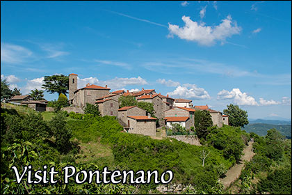
To get to Pian di Lavacchi from Casentino it is necessary to reach Talla and then climb in eight kilometers to Pontenano, at an altitude of 800 meters. In the thirteenth and fourteenth centuries it was a very coveted castle because from this area it dominates the plain of Arezzo, the Valdichiana, the lower part of the Valdarno, then in this place there were ironworks that produced weapons, which is of considerable importance. Pontenano was destroyed by the Florentine Republic in 1426. Of its important medieval past it retains a castle door and a large bell dated 1352. From here in four kilometers you can reach the panoramic road of Pratomagno on the Valdarno. Turning right in three kilometers we arrive at the crossroads which in another two kilometers goes up to Pian di Lavacchi.
To get to the starting point of the excursion from Arezzo it is necessary to go to Ponte Buriano. From here, in four kilometers on the Setteponti road, you reach Castiglion Fibocchi. Arriving we see the pleasant village on the top of a hill, right where the castle was built which later gave rise to the place. The backdrop to this view is the Pratomagno massif, exactly Monte di Loro and the Le Tre Punte cliffs, places that, as we have seen, are part of the itinerary we are going to take. Originally Castiglion Fibocchi belonged to the Guidi Counts, then it became the property of powerful families of the Valdarno. The medieval palace is the modern reconstruction in medieval style of what was once the home of the lords of the past. The most significant architectural testimony of the ancient castle is Porta Fredda, so called because it faces north. A visit to Castiglion Fibocchi is really pleasant, for its architecture, the narrow alleys, the interesting church rebuilt on the castle chapel. To head towards Pratomagno from Castiglion Fibocchi, continue for another four kilometers on Strada Setteponti until the deviation, to the right, which climbs to Passo della Crocina. After 7.5 kilometers, take the Panoramica del Pratomagno sul Valdarno on the left, which in six kilometers leads us to the detour that climbs to Pian di Lavacchi.
To reach Pian di Lavacchi from the Valdarno it is necessary
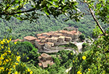
  to go to Loro Ciuffenna, a picturesque village of medieval origin included among the most beautiful villages in Italy. This tells us that the place is worth a visit. Furthermore, a short distance from the village is the Pieve di San Pietro a Gropina, a Romanesque church declared a National Monument. Its capitals and a pulpit in Lombard style are something extraordinary. From Loro Ciuffenna, following the signs for MOUNTAIN FRACTIONS, we reach Anciolina, 933 meters above sea level. Some archaeological finds found here suggest that the small village originated from an Umbrian settlement. Its name may derive from Ancla, which in ancient Umbrian meant eagle. As these large birds of prey nest among overhanging rocks, Anciolina is located on a rocky spur on the southwestern slopes of the Pratomagno. From here we have an extraordinary view over the Valdarno, the Valdichiana up to Lake Trasimeno and the plain of Arezzo. For this reason, the castle that was built here in the first half of the 11th century was much disputed and a reason for guerrillas to conquer it. At first it was owned by the Guidi Counts, then passed to the Ubertini of the Soffena branch. From Anciolina, in five hundred meters we reach the panoramic road of Pratomagno. We take it to the right and after a couple of kilometers we arrive at the detour to the left that takes us up to the starting point of the hike.


